
4/23/26
Today we finally headed back toward home. We picked up a rental car and drove to Albuquerque, and tomorrow we’ll drop the car off in Pueblo and grab the bus to Moffat, just outside of Crestone. We’re both glad we tried the AZT and proud to have done the first half, but I think we’ve learned that we are much more attuned to the slower pace of regular backpacking like we did in the Grand Canyon. We are excited to be home and relaxing for the foreseeable future, and feeling great after all the persevering we managed to do as a (now engaged!) couple to get through the rough road from Old Mexico. We’ve got a few months to help Josh and Monika with their wedding planning, visit mom and dad in Houston, and enjoy summer before our next adventure!
4/22/26
This morning we got back in touch with Krocky to get a ride back to Flagstaff. On the way, we stopped in the San Francisco Peaks for a brief walk through the aspen groves up there. We got to town and wanted to celebrate our engagement and being done with this adventure, so we made a reservation at a nice restaurant in town. The meal was decadent! The highlights were mussels and hominy in a Calabrian chili broth, roasted duck breast with Brussels sprouts, and coffee cake with backed apple ice cream for dessert. Just what we needed after eating so much lukewarm gruel this past month!
4/21/26
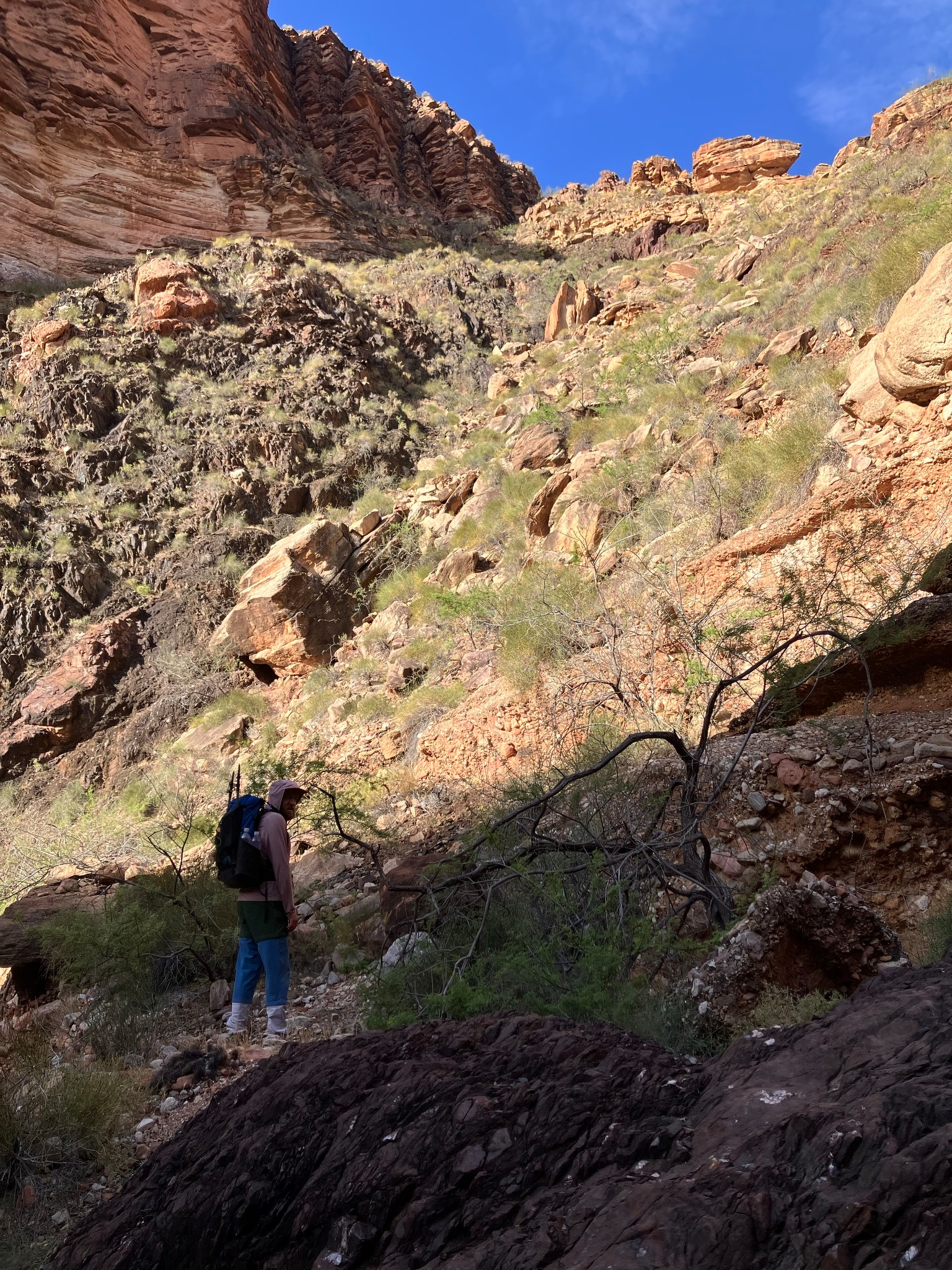
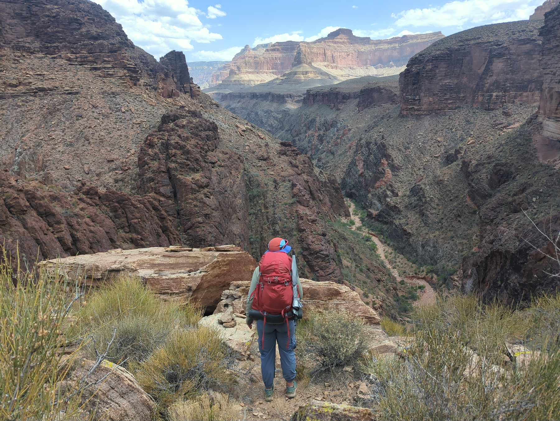
We scrambled back out of Slate Canyon and made the short trek over to Boucher Creek, a perennial stream where we recouped for a bit. We have a permit for two more nights in the canyon, with short hiking days between them, but we are both feeling pretty wiped out at this point from everything, and we’re both feeling ready to get home and be done hiking for a while. So we decided to take an alternate route out of the canyon today, up the Boucher Trail, supposedly one of the harder trails on the south side. It took the rest of the day to climb out of the canyon, and luckily the trail wasn’t too bad other than a few scrambles here and there. We got to the top at Hermit’s Rest and took the Park Service shuttle back to the village, and from there got a ride to Tusayan. It was dark at that point, so we decided to just grab dinner and stay in town tonight.
4/20/26
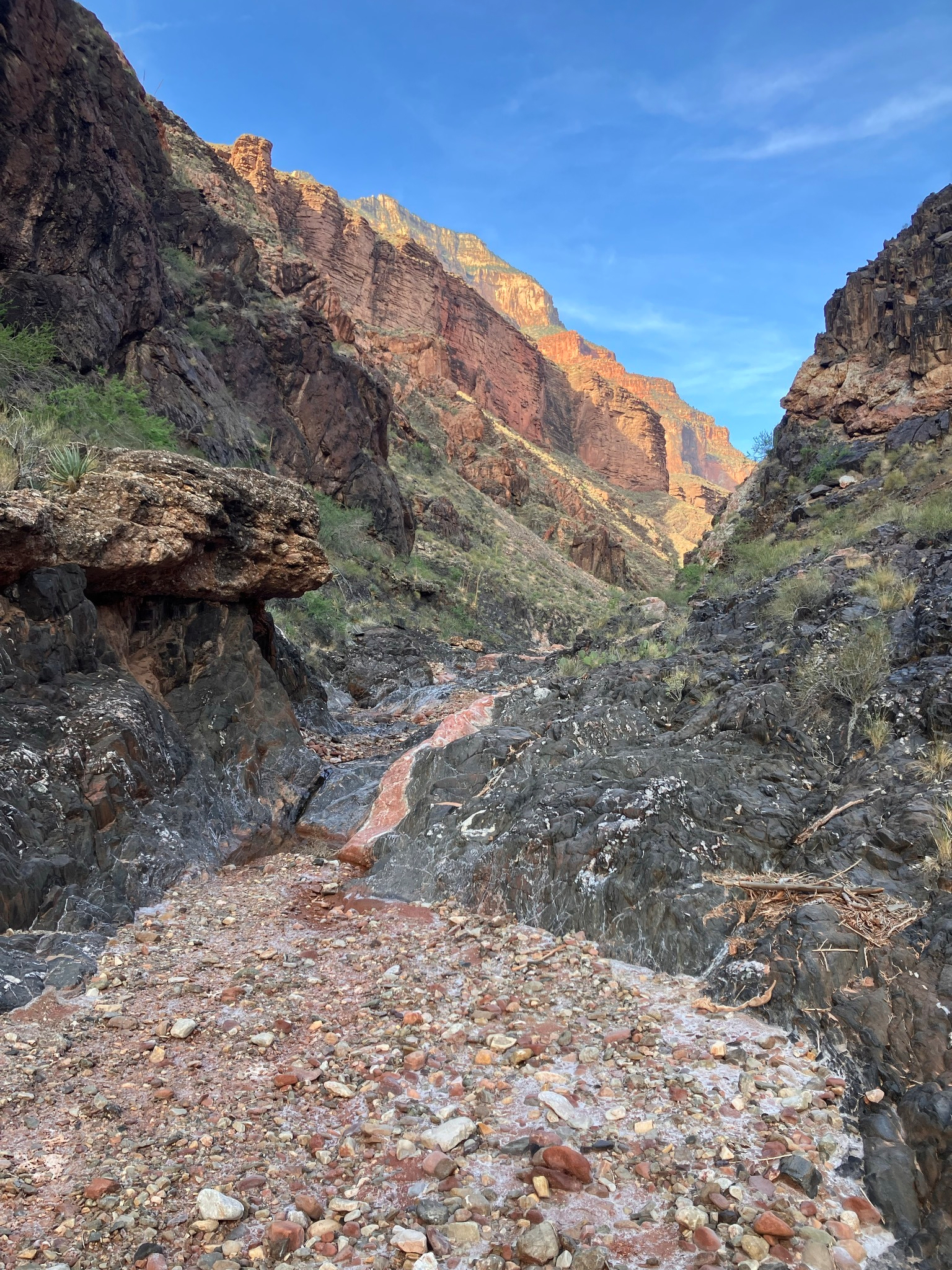
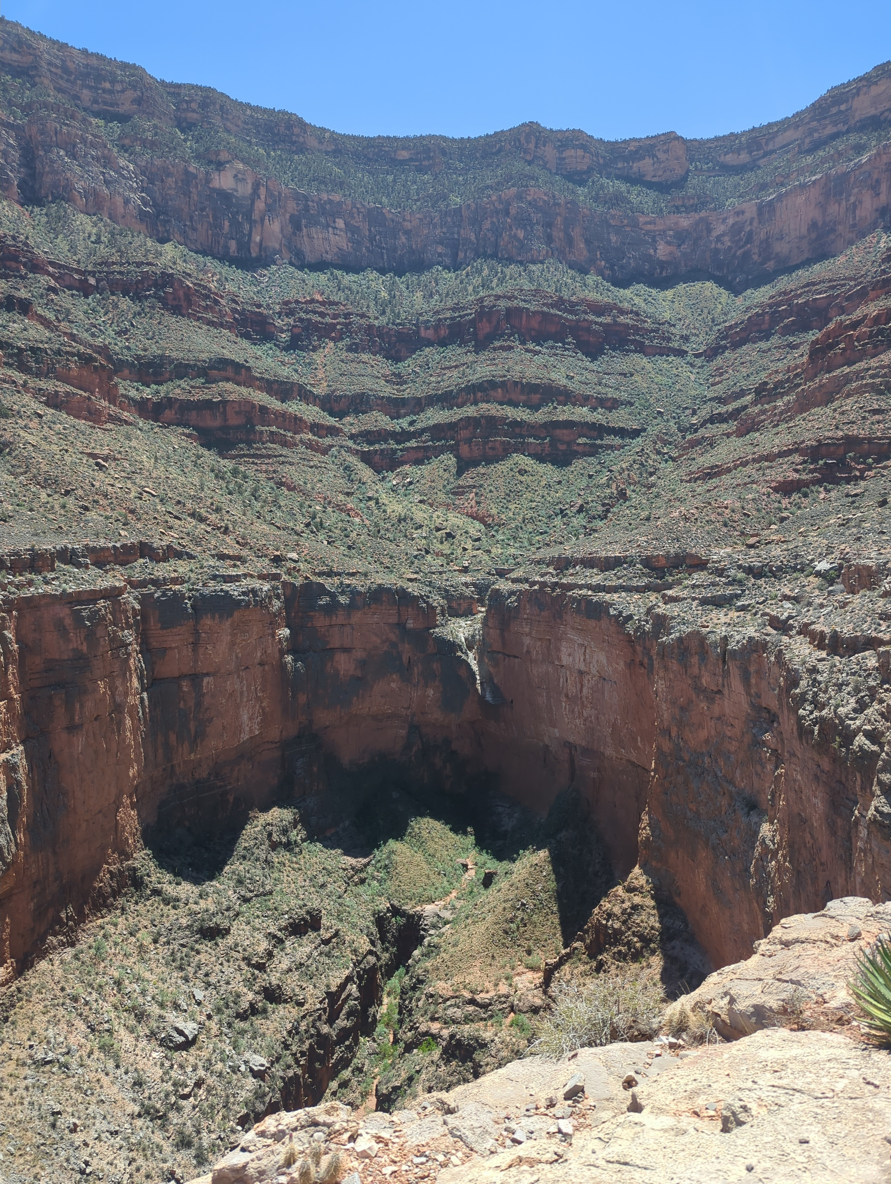
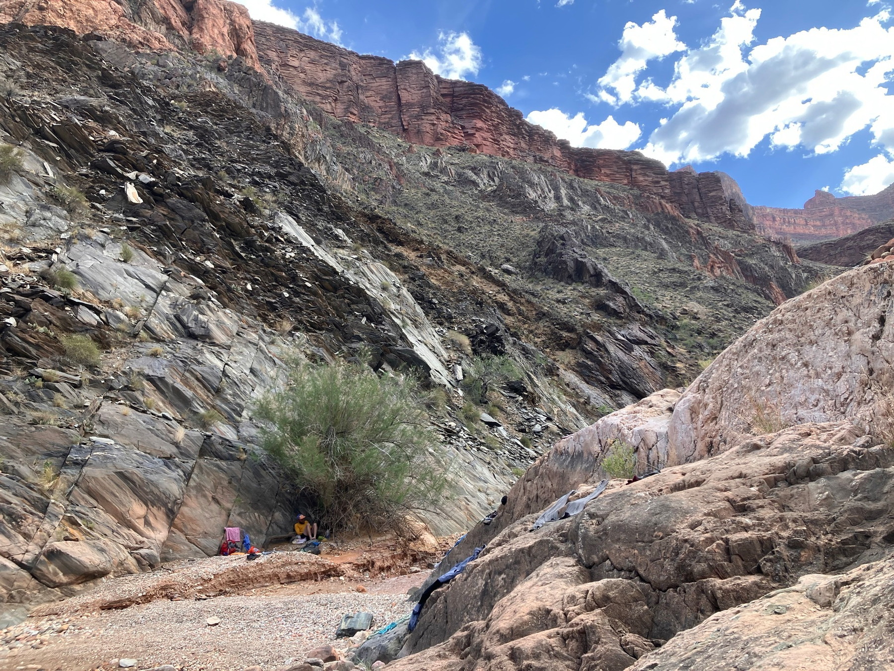
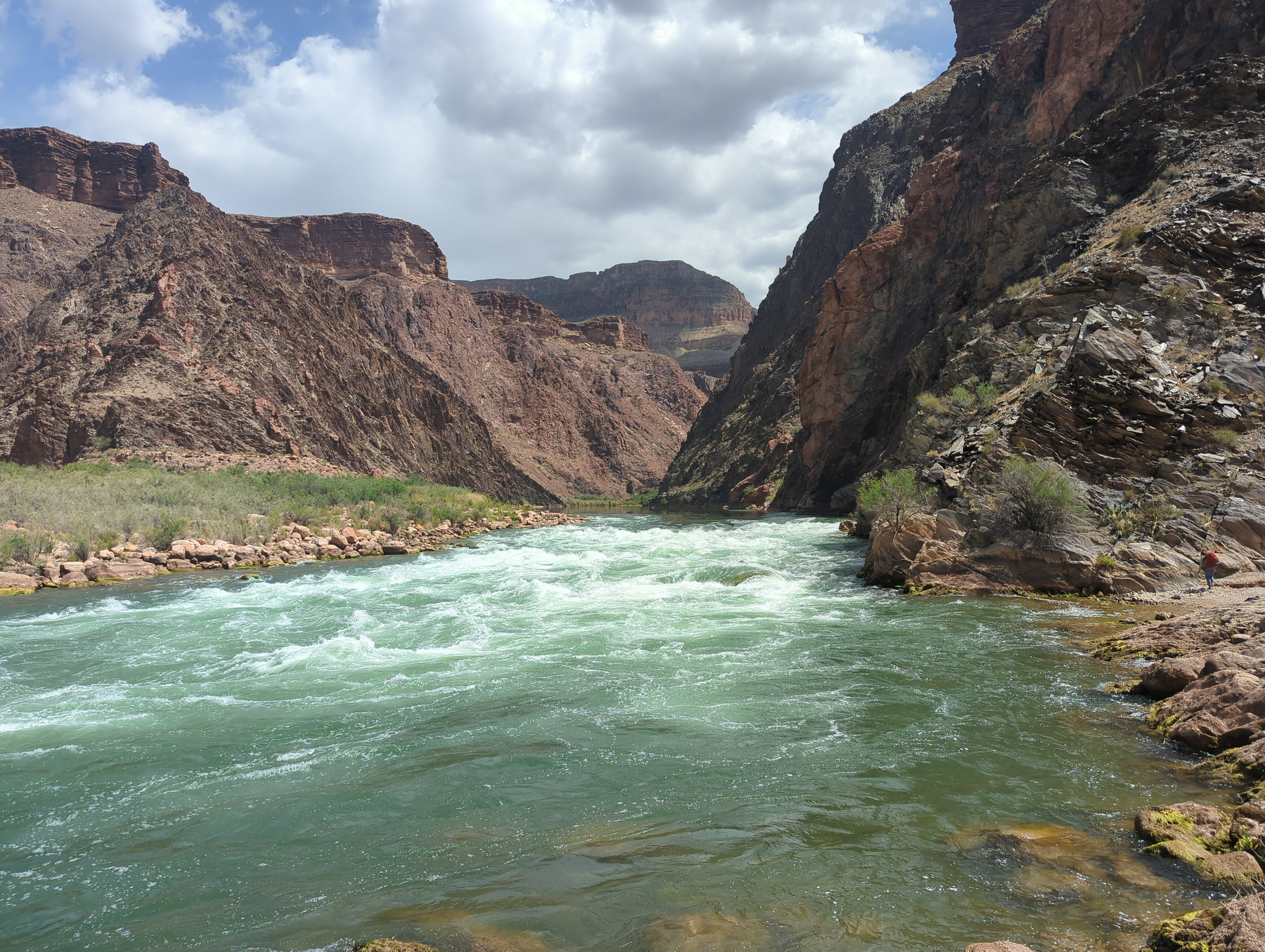
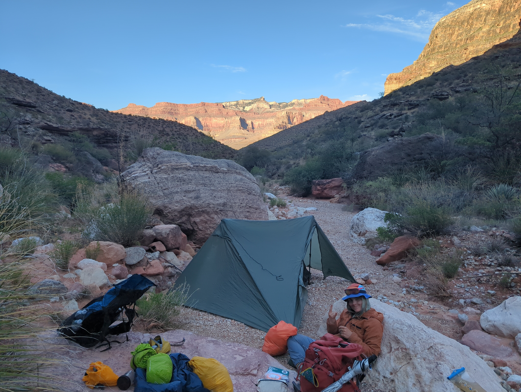
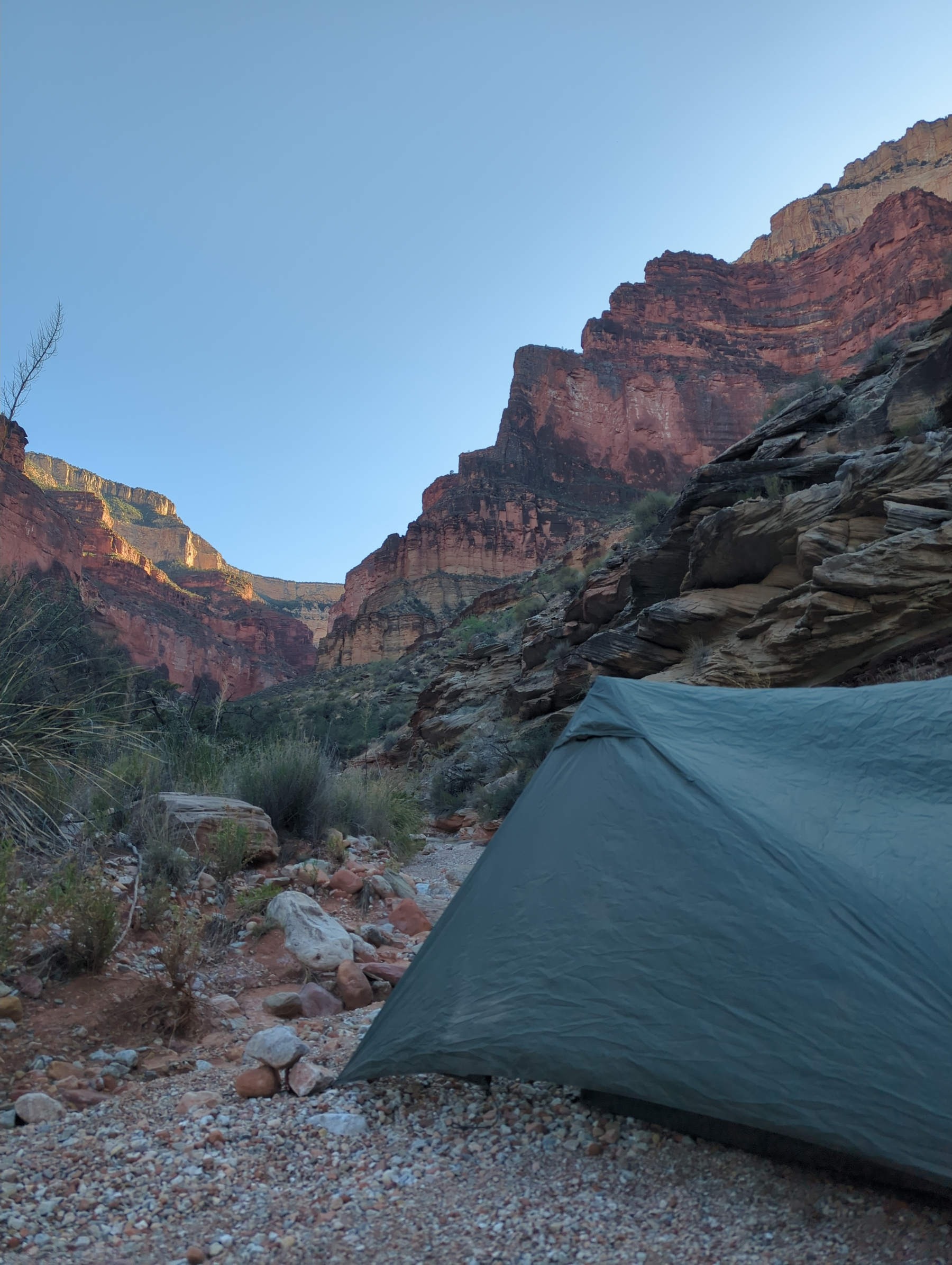
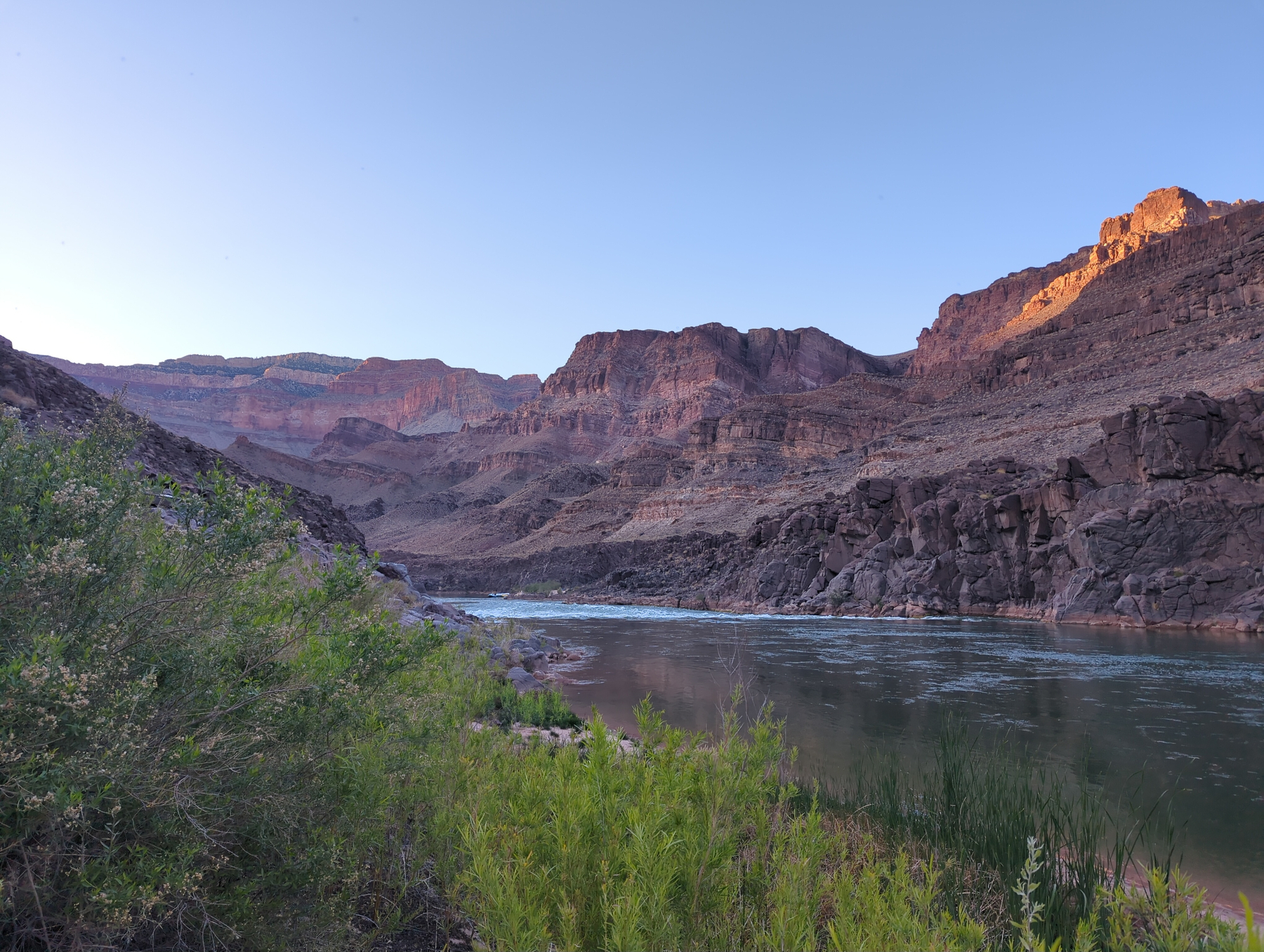
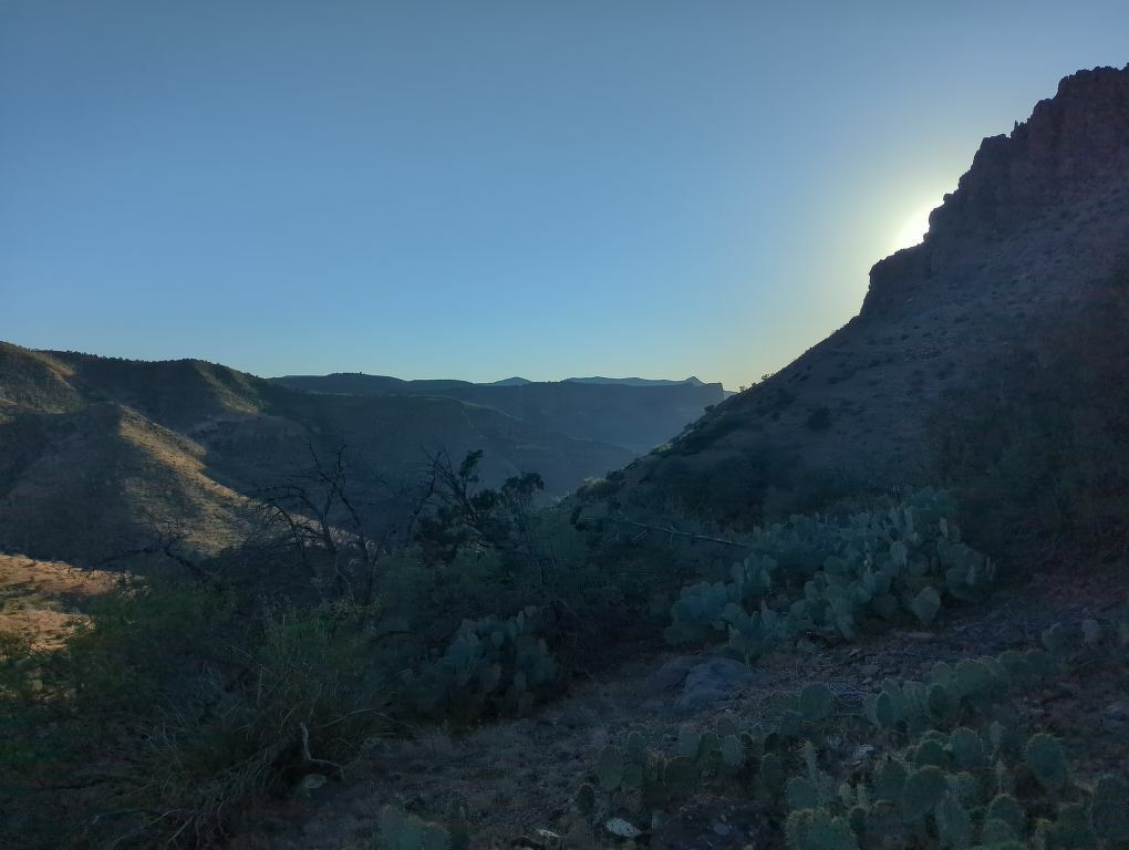
Our destination today took us to Slate Canyon. We hiked there pretty early in the day and decided it’d be fun to camp at the river again. The rangers at the village told us about a route for scrambling to the river from the trail here. It ended up being a little intense, but we managed to get down and worked our way to the bottom of Slate to the infamous Crystal Rapids. We took dips in the freezing water and hung out for most of the day on the little beach there. It would be hard to stop here by boat because the canyon opens up right into the rapids, and the scramble to get here on foot wasn’t for the faint of heart either, so it really felt like a secluded spot to spend the night.
4/19/26
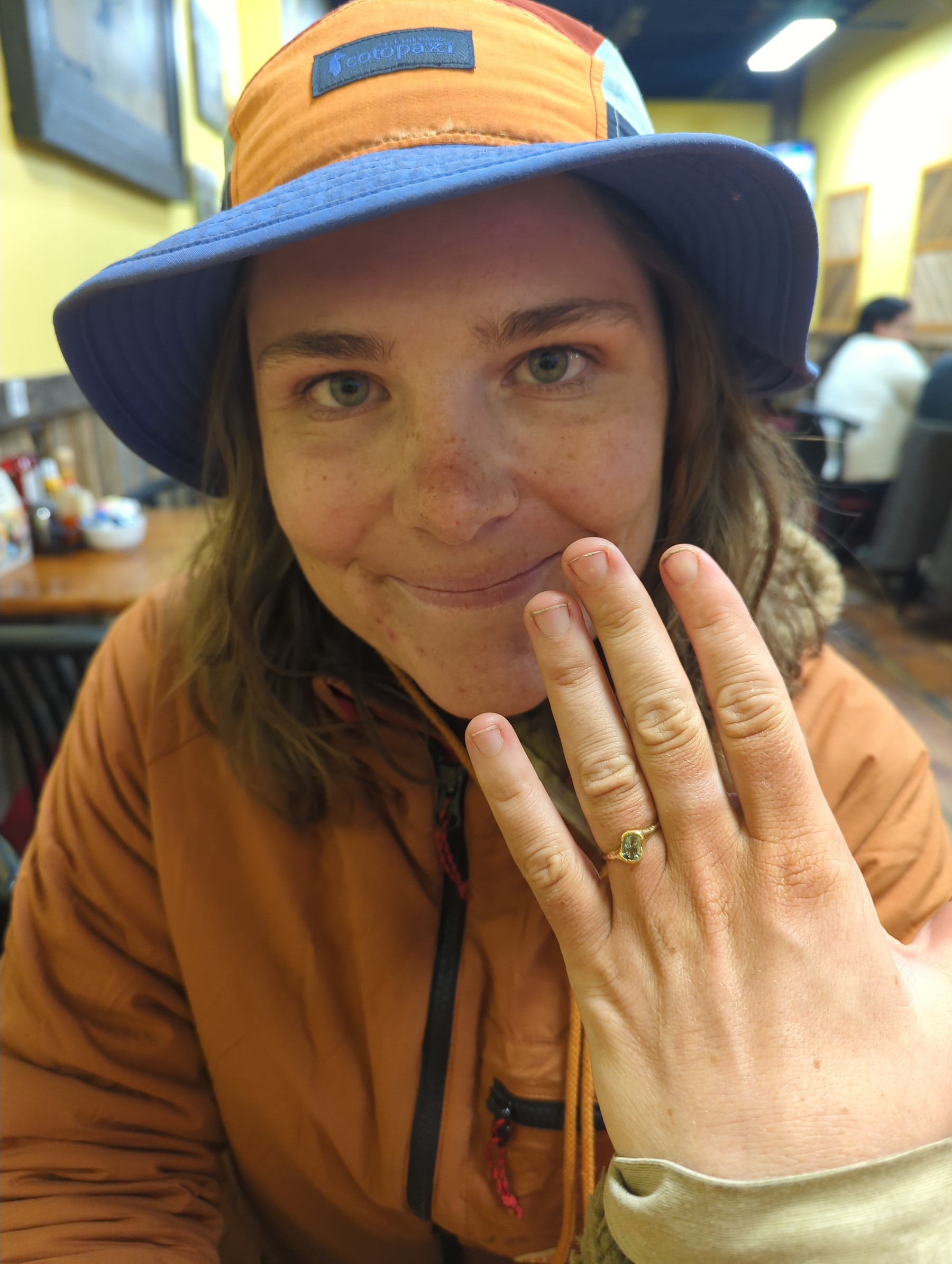
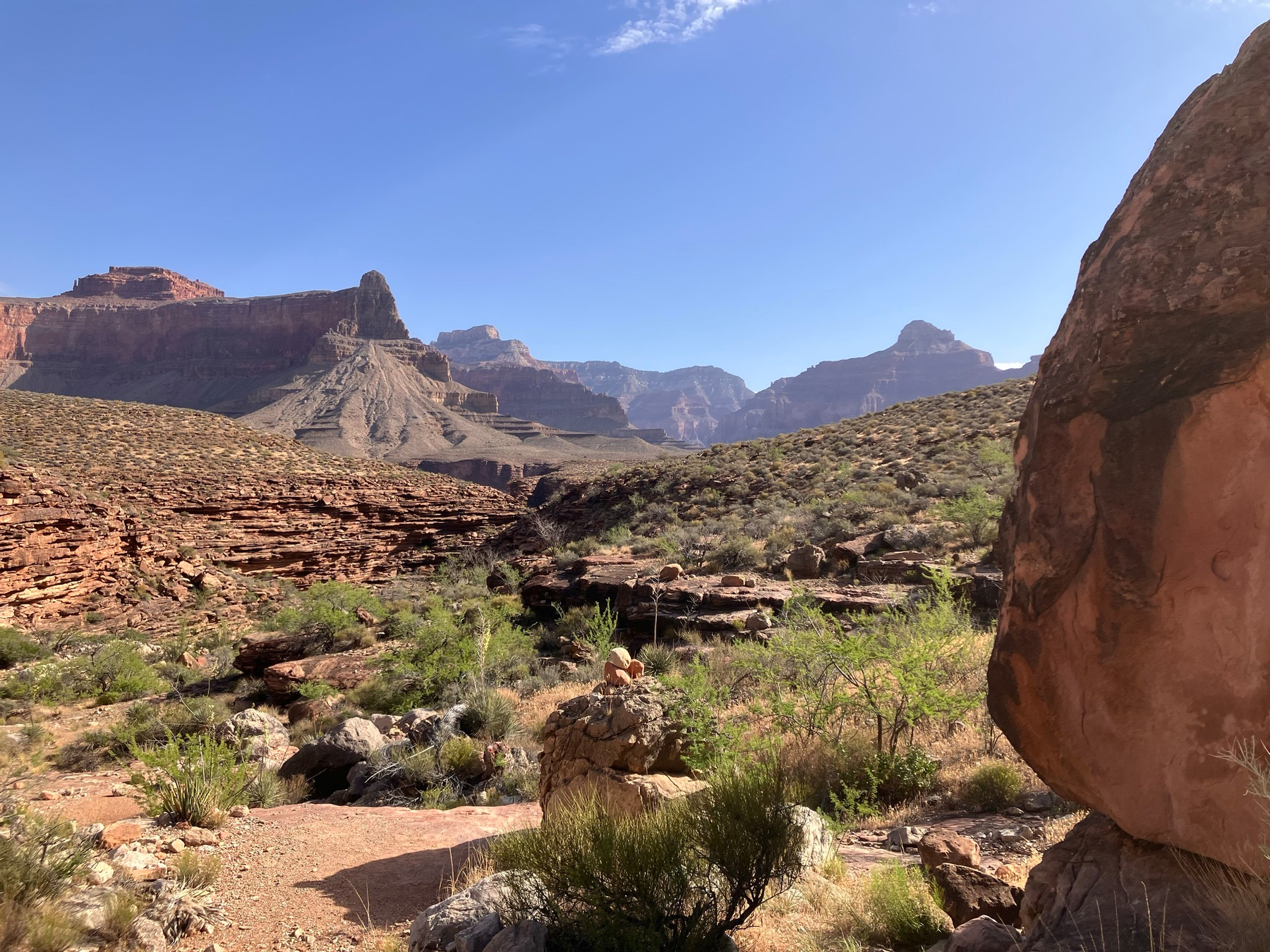
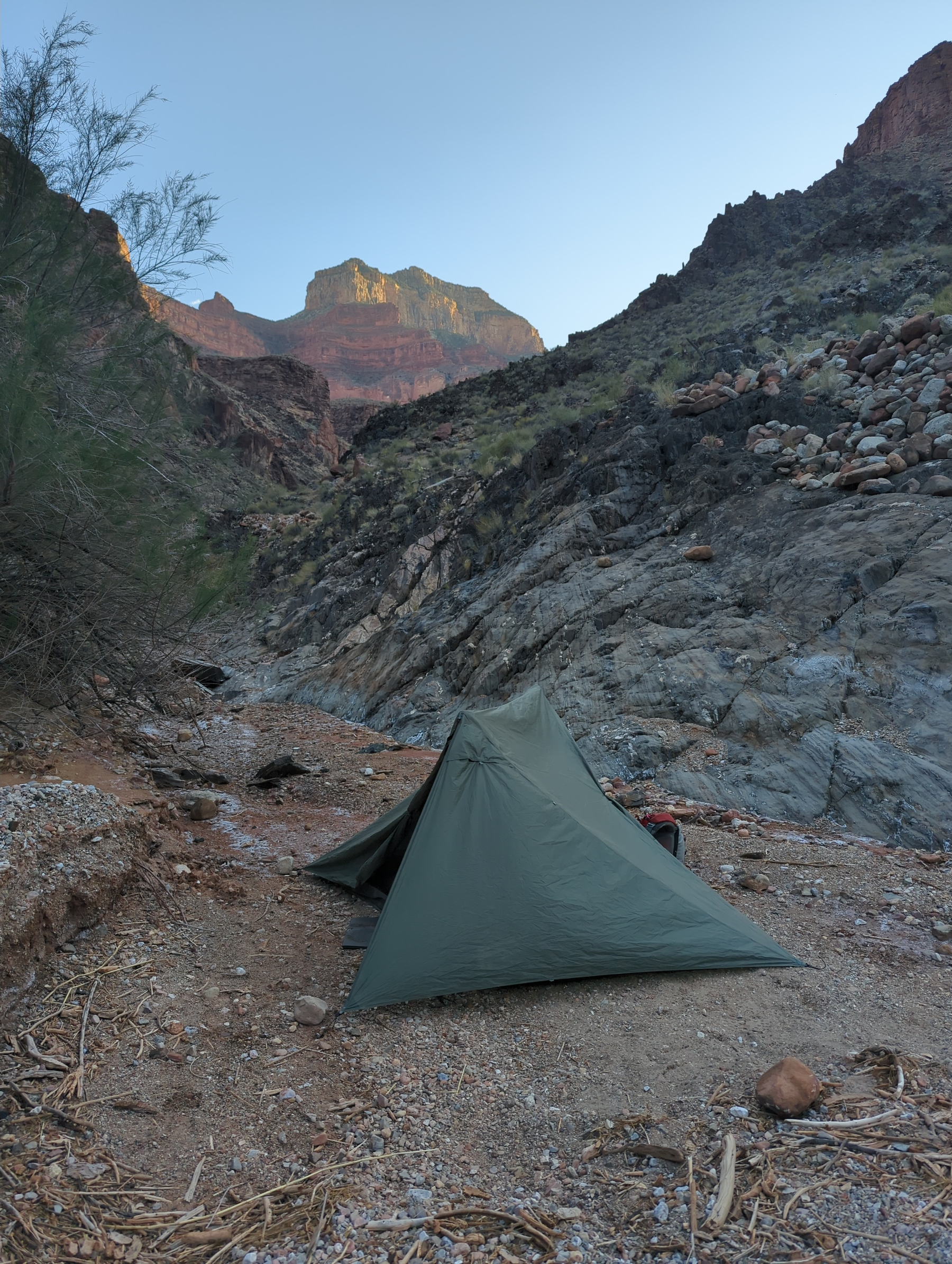
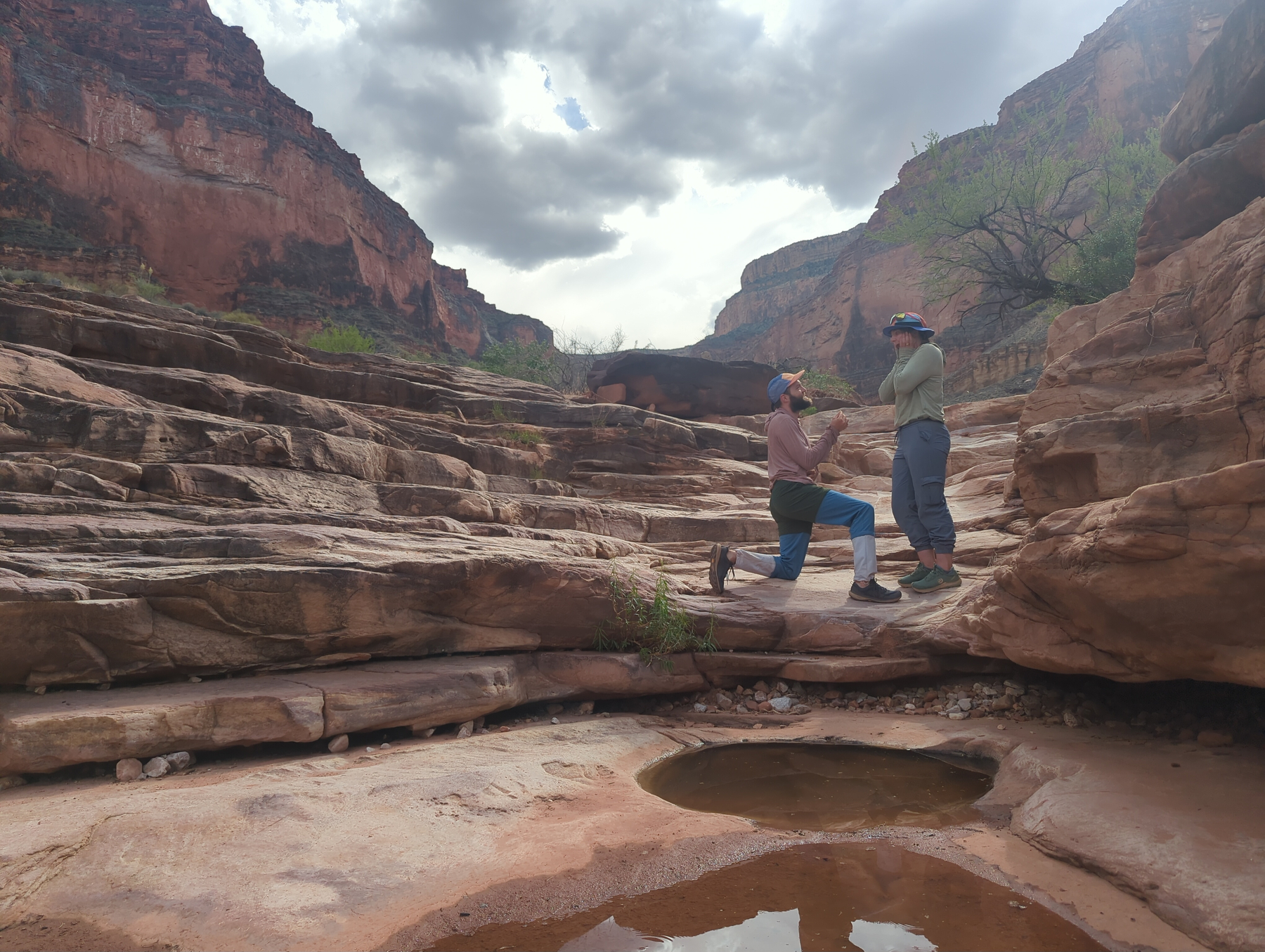
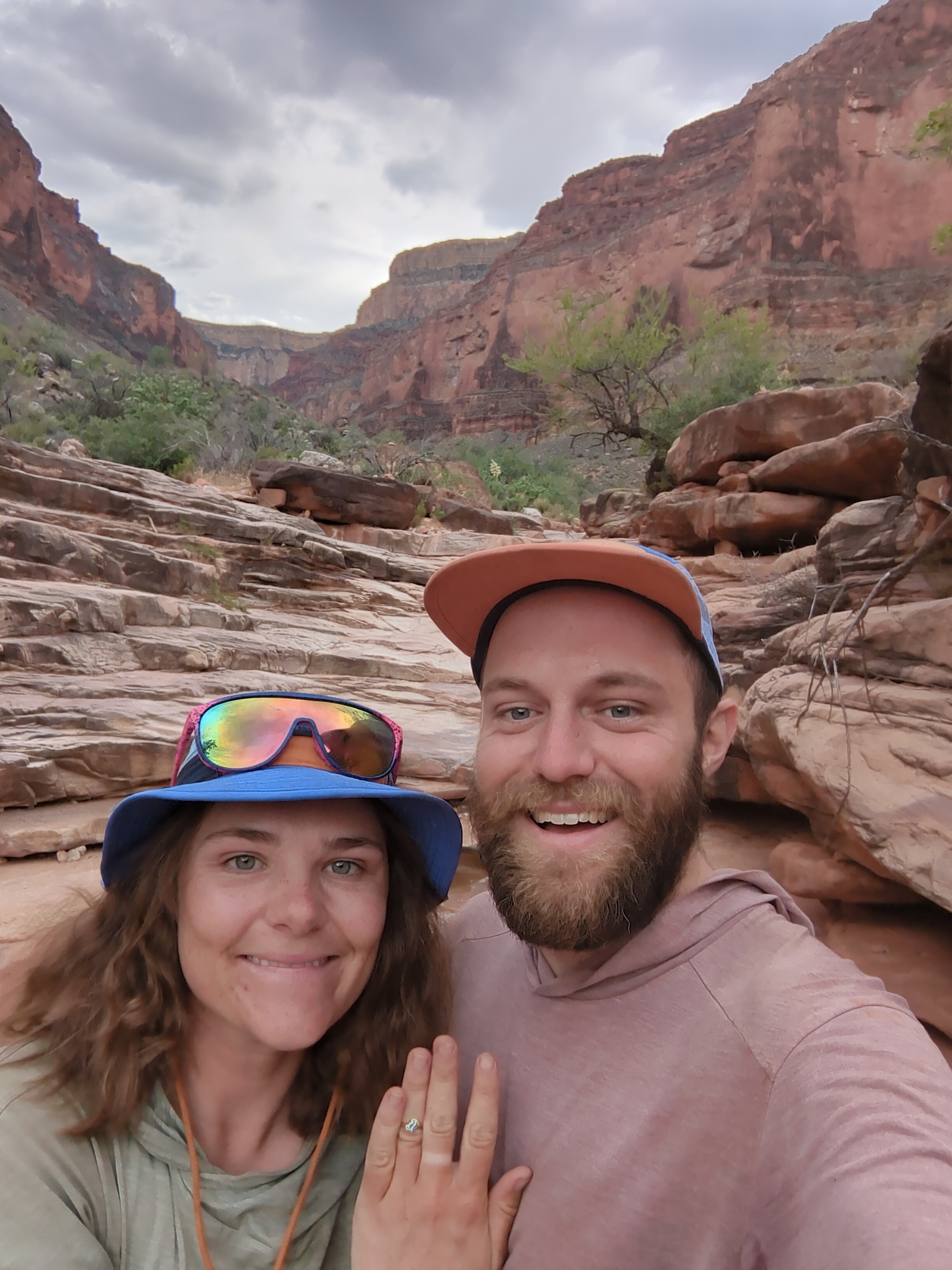
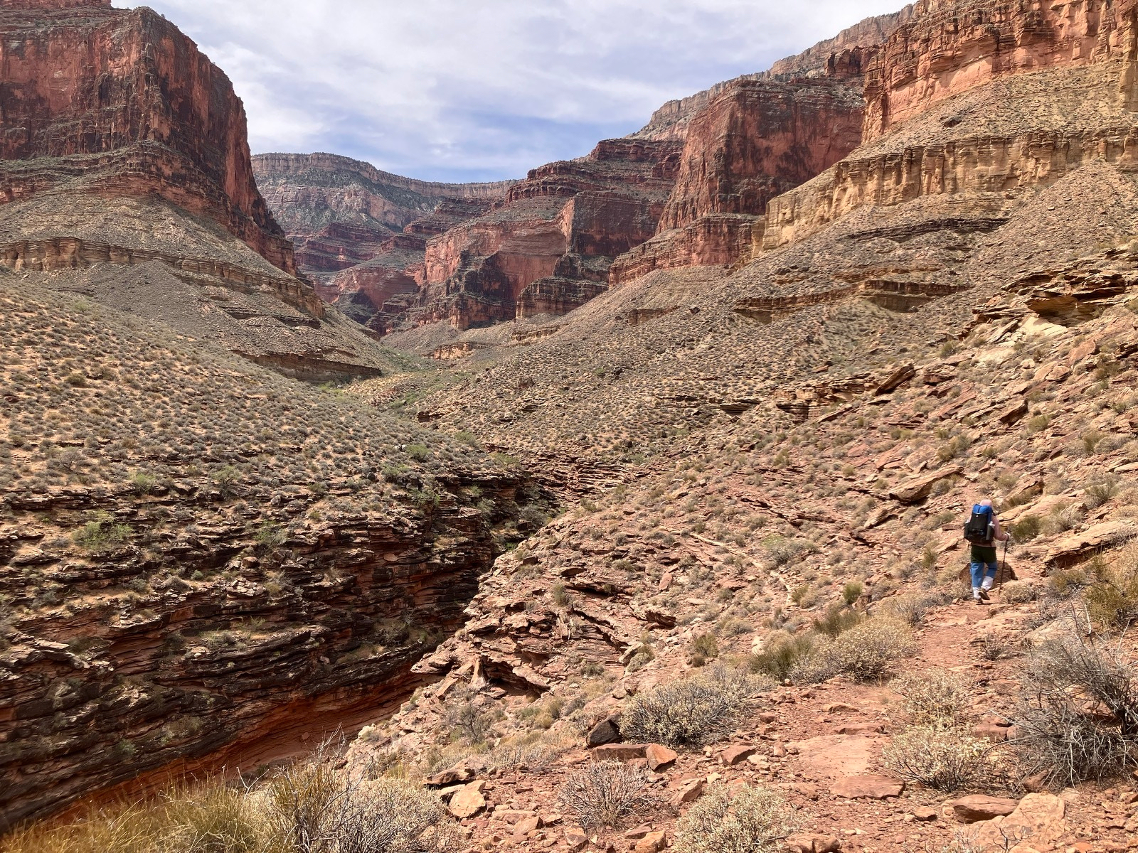
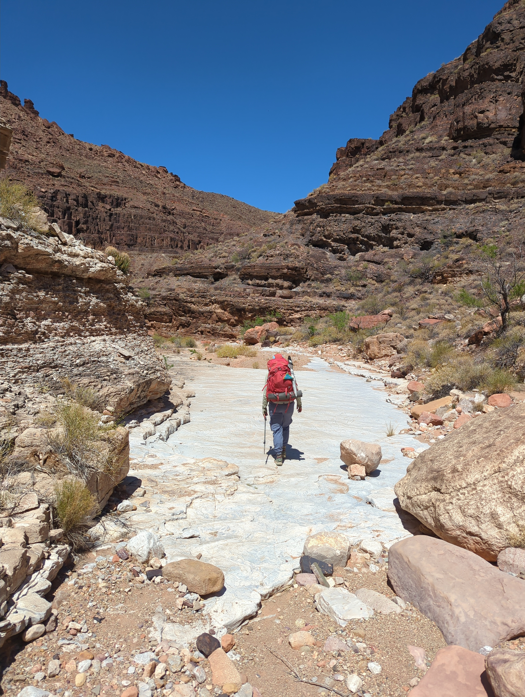
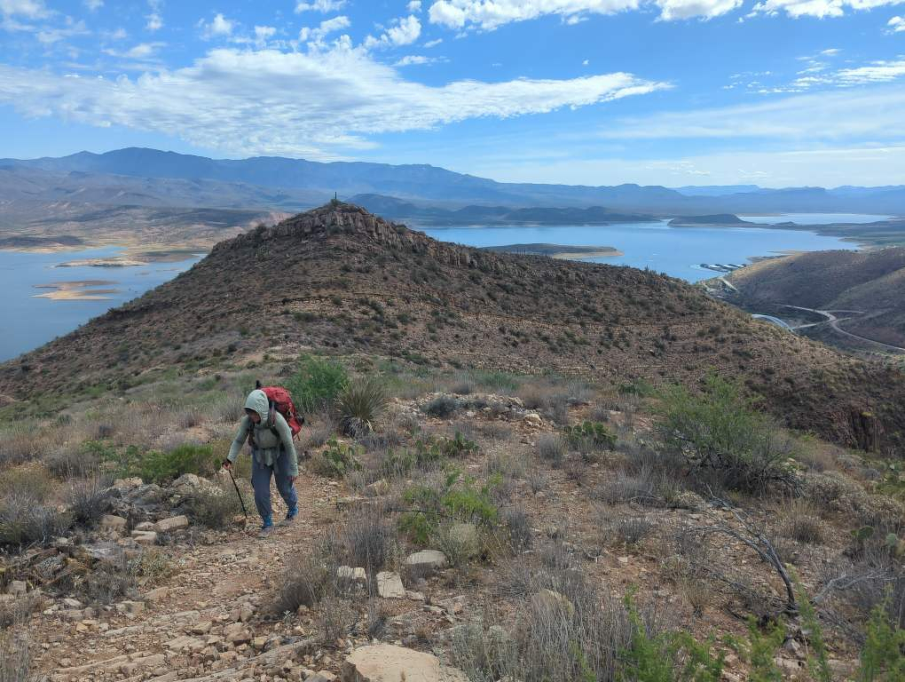
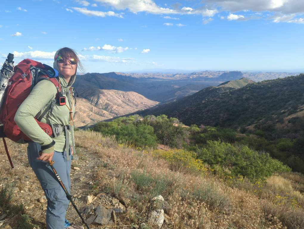
Today our packs were back to being relatively light, thank goodness. We hiked out of Ruby and toward Sapphire, our hopeful destination for the evening. We knew there would be water there. We got there in the early afternoon, and we split up to look for good campsites. Rose is always on the lookout for cool-looking rocks, so I came back with one for her… a sapphire ring! I asked her to marry me, and she said yes! We hung out in the canyon for the rest of the afternoon, letting the exciting news sink in and waiting out the heat of the day. We didn’t find any good campsites down in the side canyon, so in the evening we hiked a mile or so out to the Tonto Platform to camp out there.
4/18/26
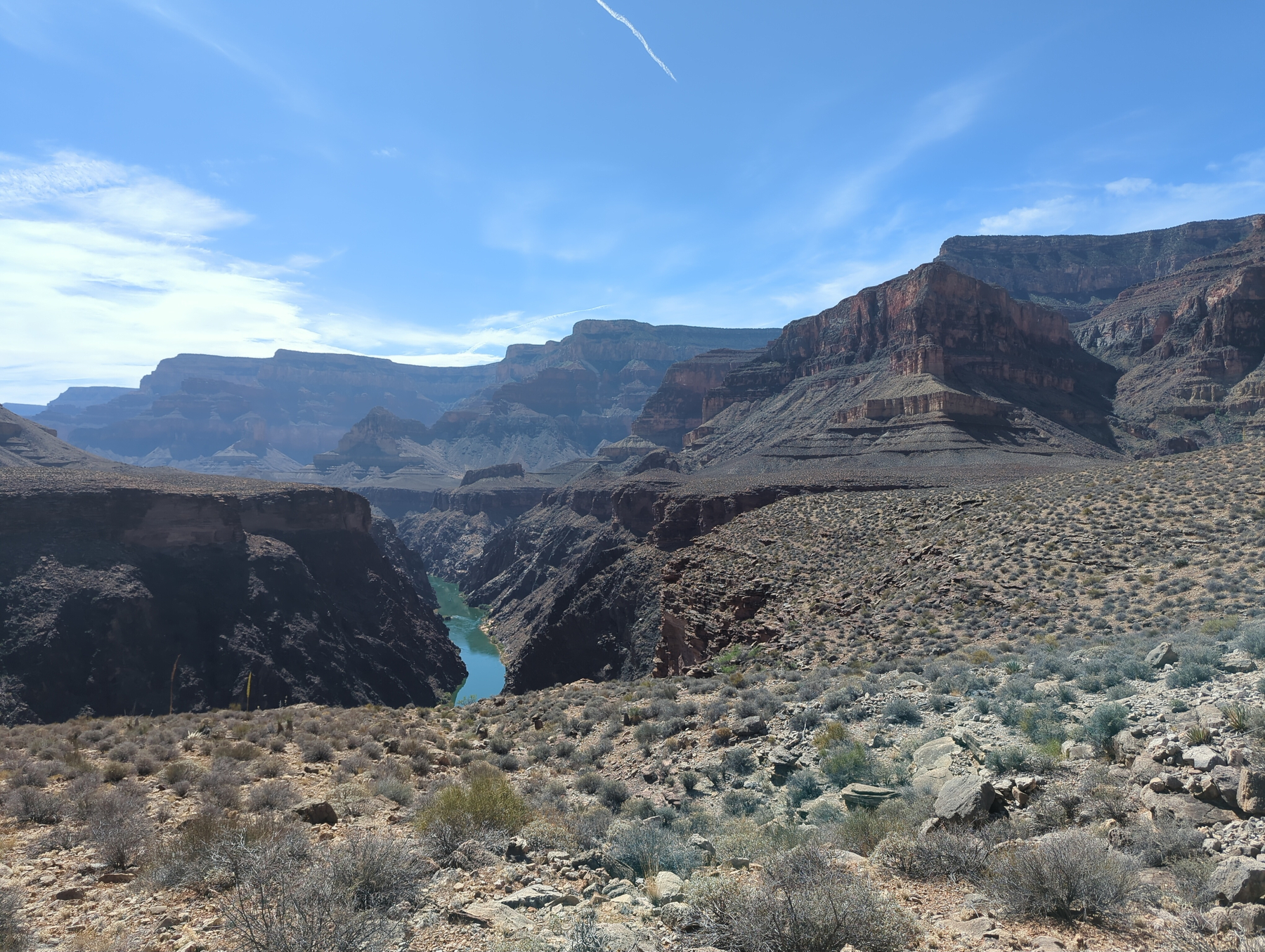
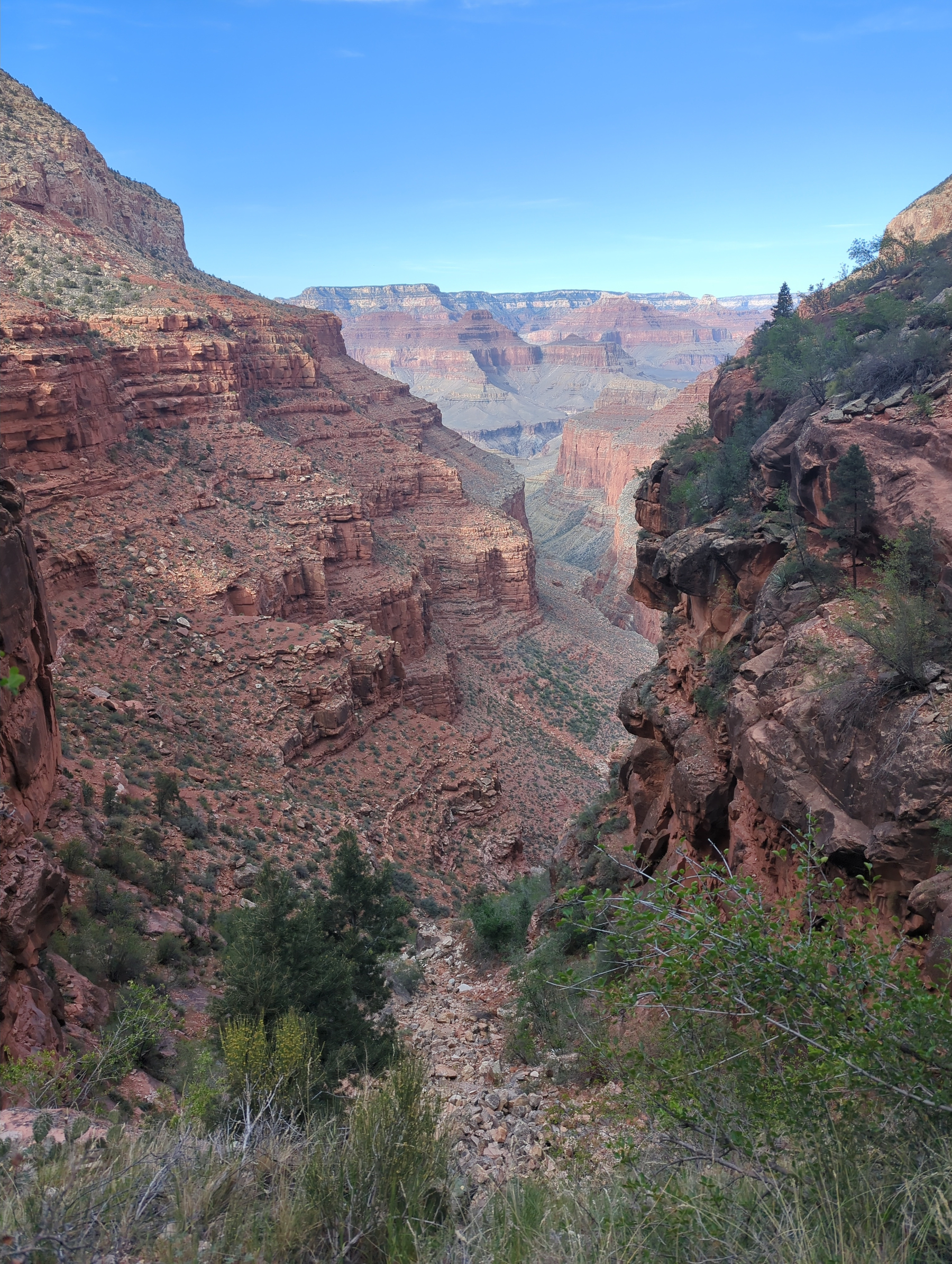
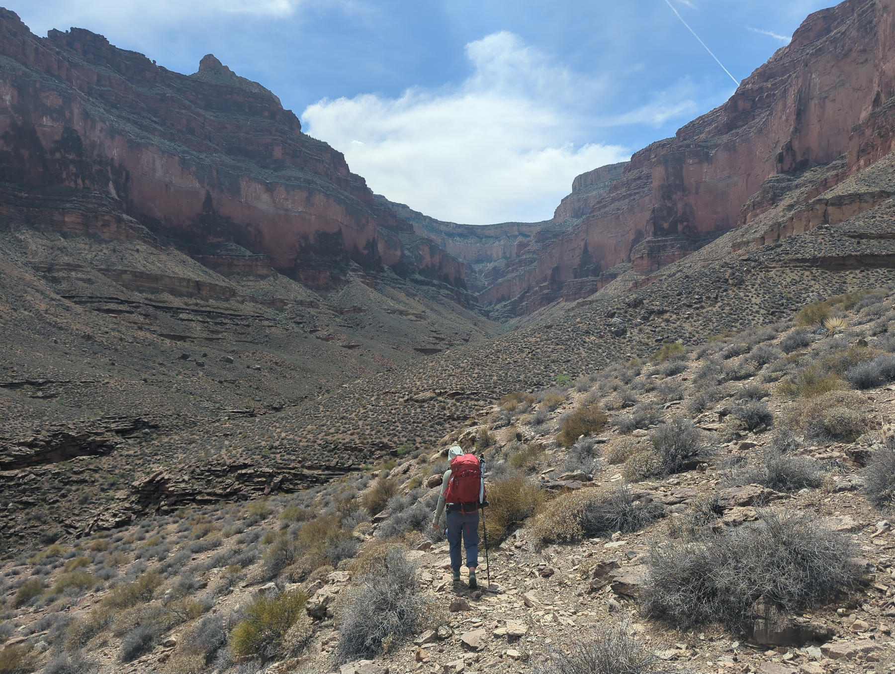
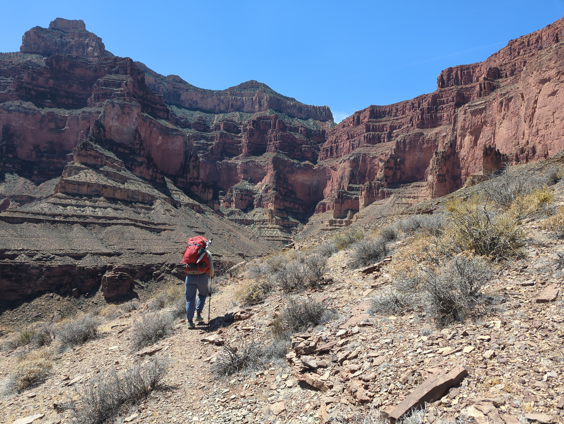
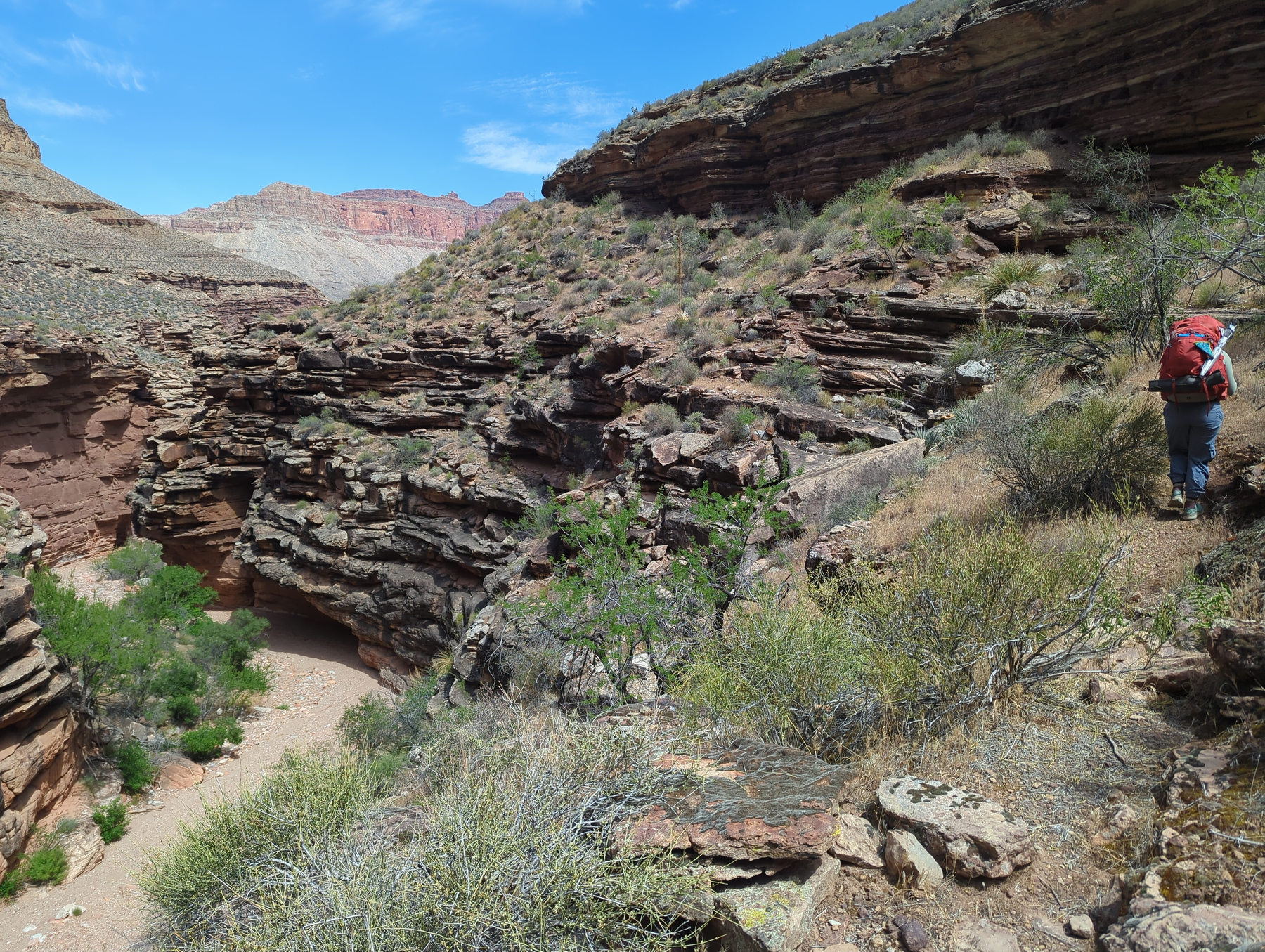
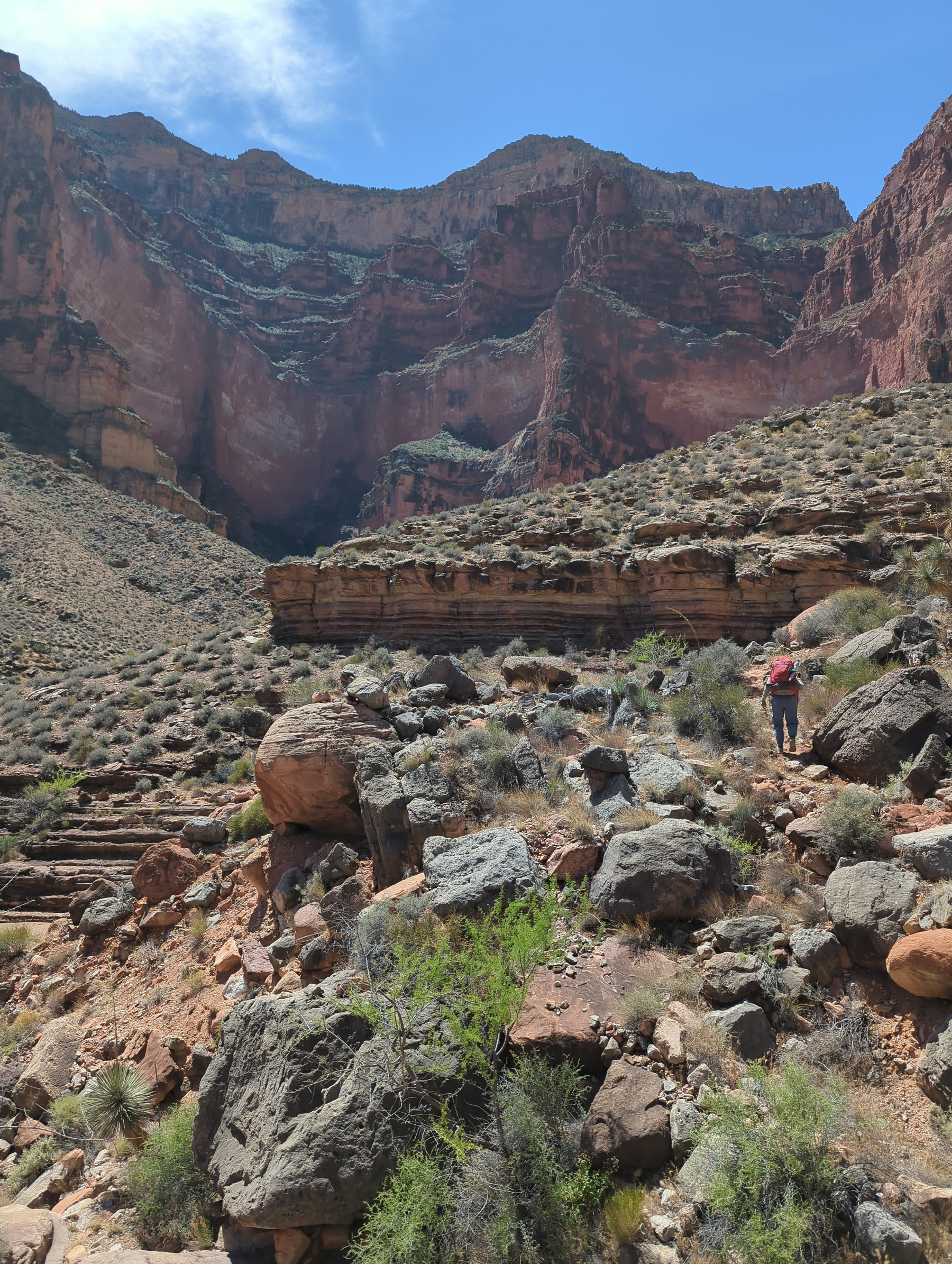
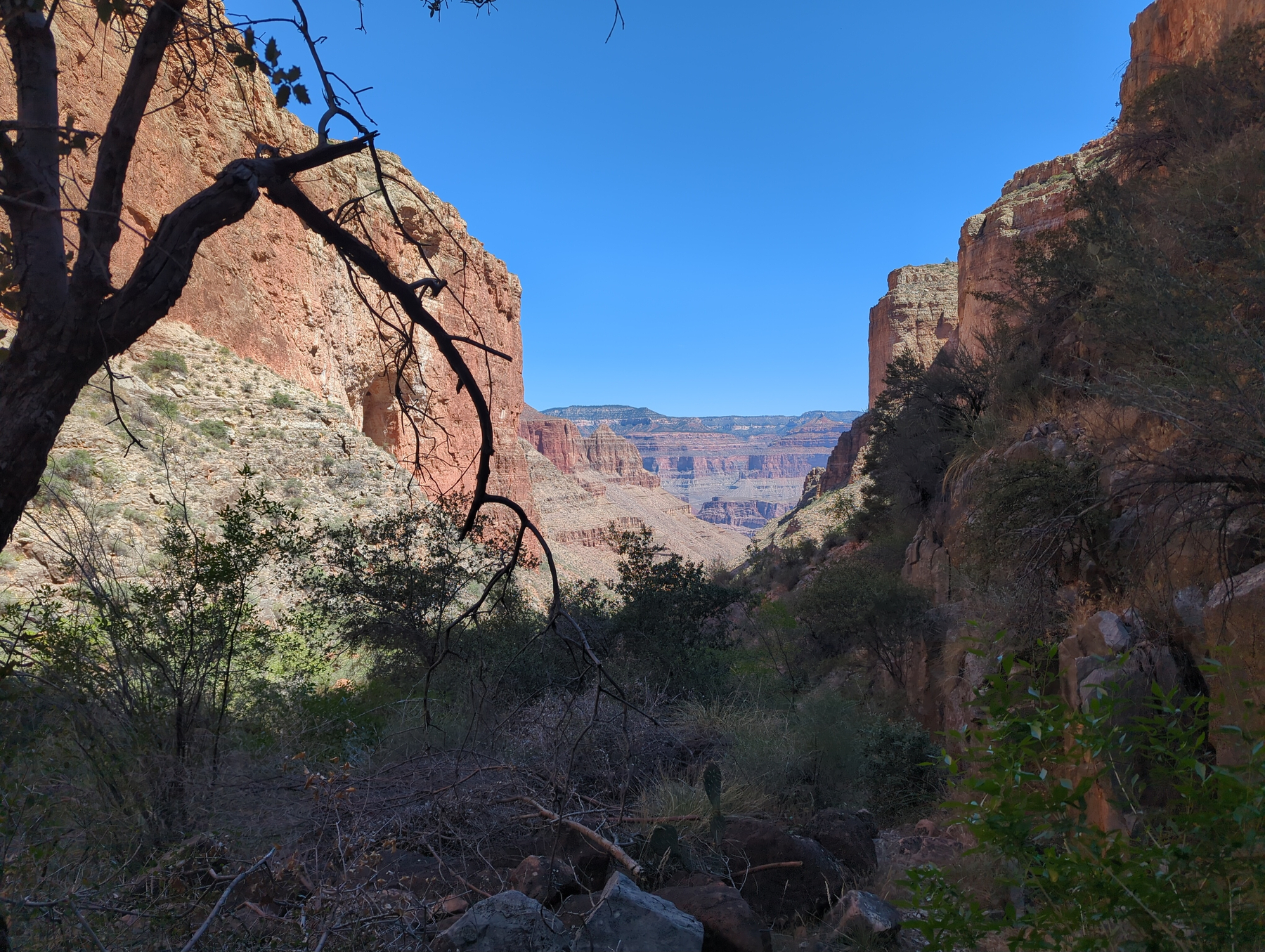
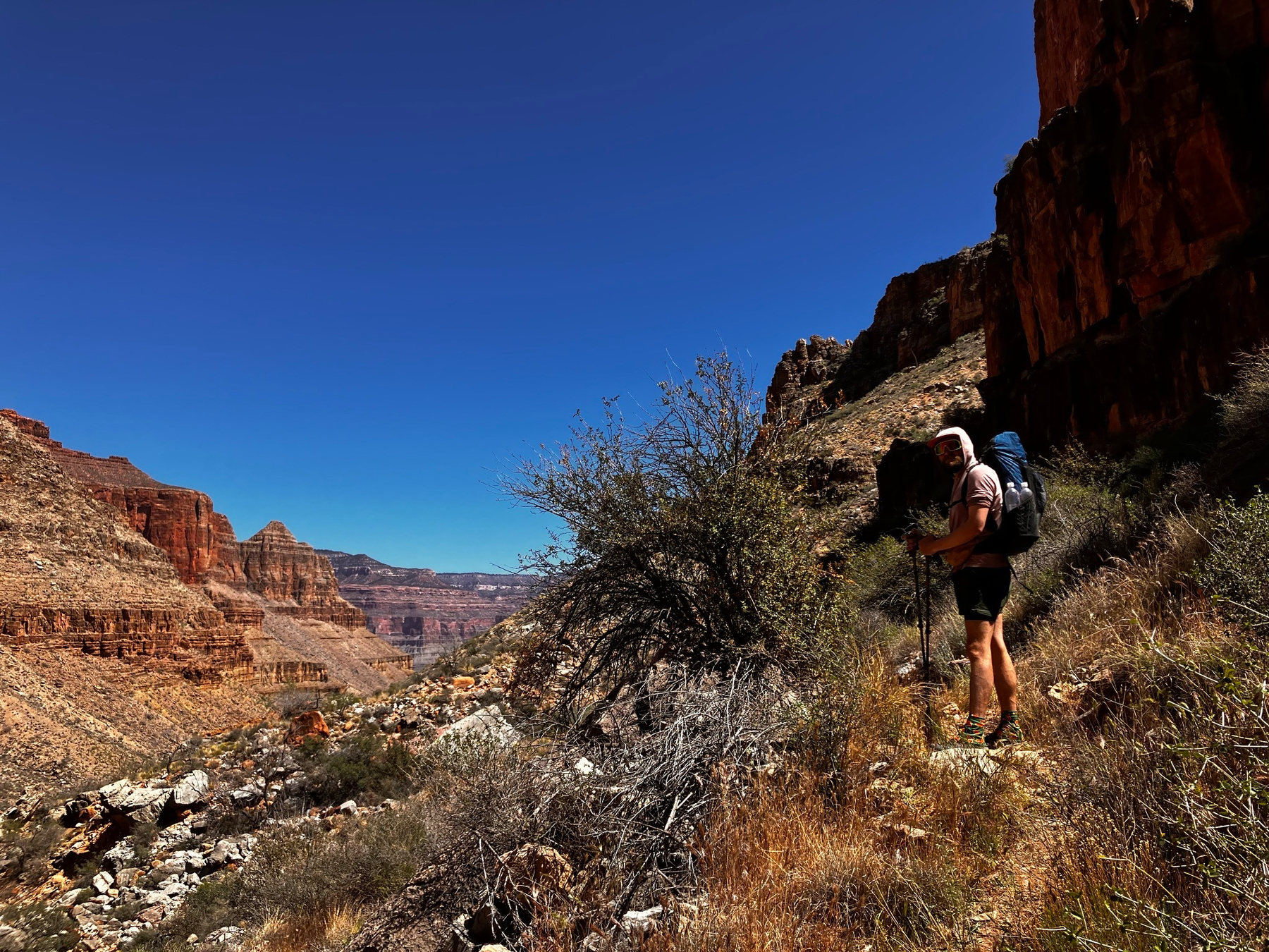
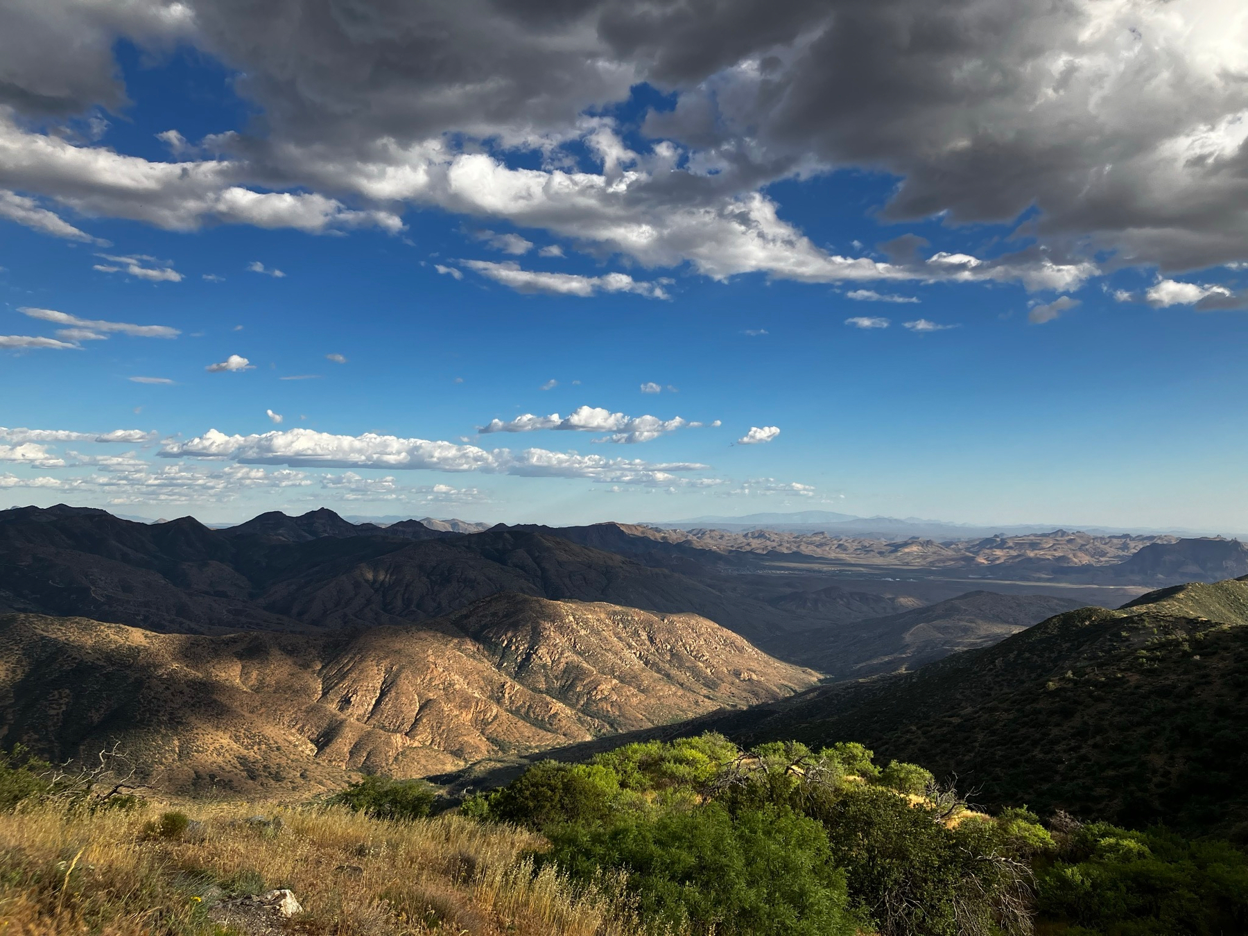
Today proved to be an exhausting one. Our route took us back up South Bass Trail to the Tonto Trail, which traverses a major stretch of the Grand Canyon’s length. The Gems Route works its way along the driest portion of this trail, and we didn’t expect to find water for about 20 miles after leaving the river today. Since we planned to go slowly through the canyon, we’d have to dry camp tonight too, so we each carried 7 liters to get through the next two days. Woof! With the 6 days of food we’re carrying, it was by far the heaviest load of the trip.
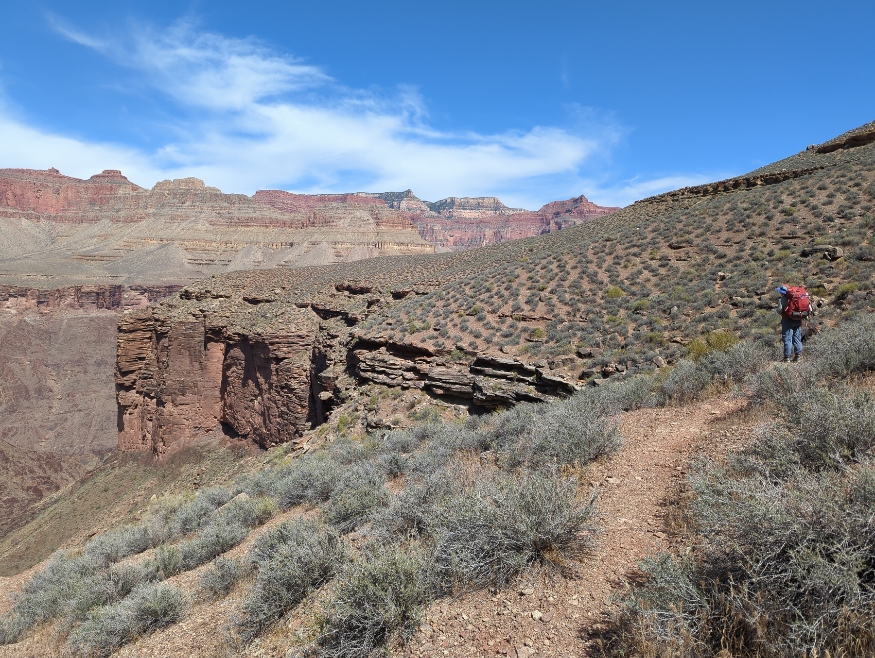
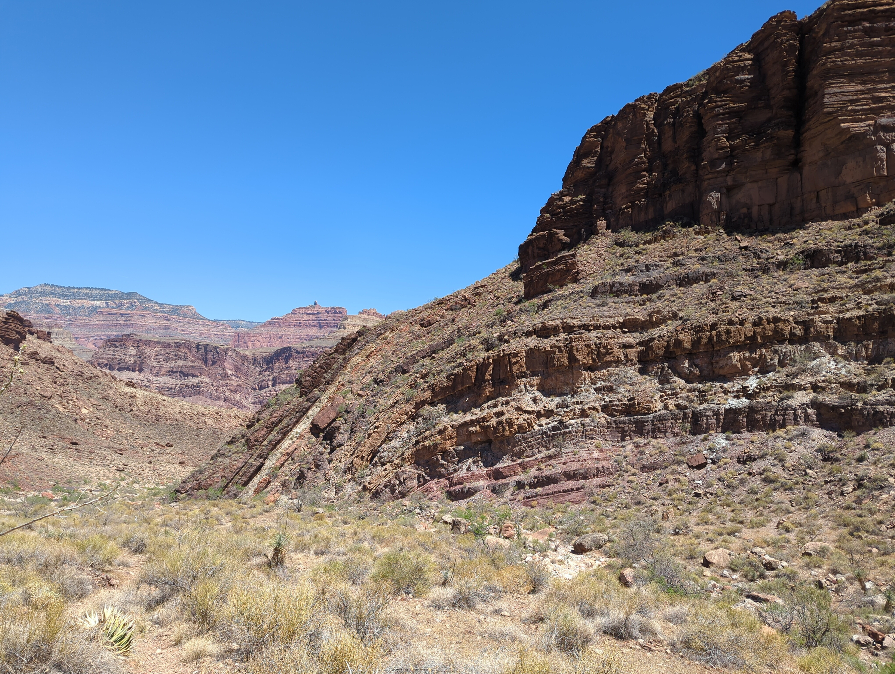
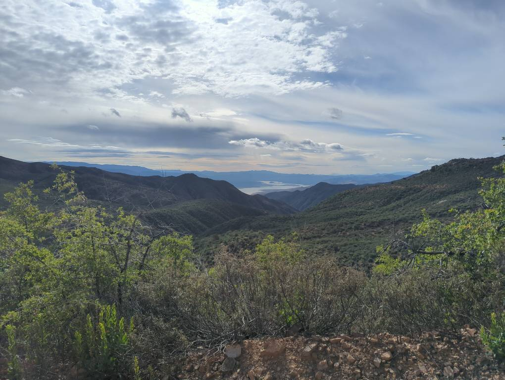
We worked our way out of the Inner Gorge and met back up with the Tonto Trail before turning east. The views up on the Tonto Platform were striking all day; it really feels like you are suspended on a huge park bench, with towering red walls on one side and the drop to the river off to the other. We made our way past a number of side canyons, each one gorgeous enough to be its own national park and deep enough that the trail has to meander miles just to get into and out of it. We slept at Ruby Canyon, the first “gem” we’d encounter on the trail. Luckily, there were a few small, unexpected potholes of water here, which bodes well for the rest of the route.
4/17/26
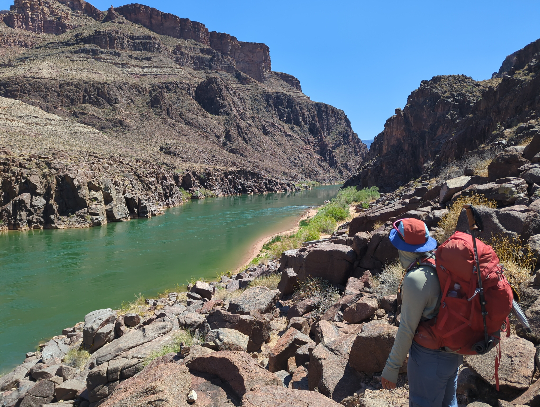
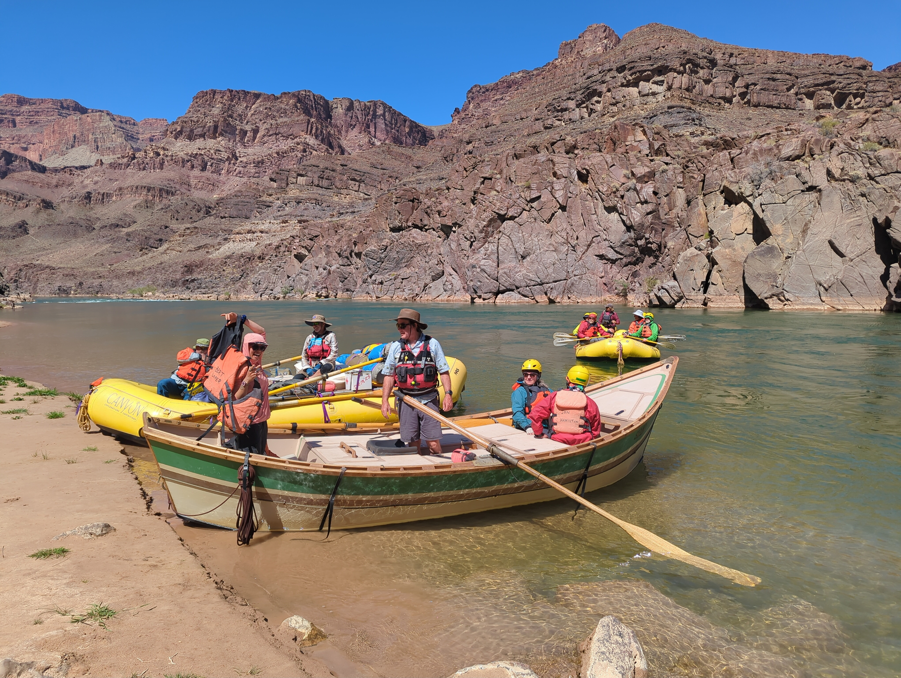
While eating breakfast this morning, we crossed paths with Ariana, a solo hiker we’d met on the very first day of the trip. She hiked all the way here from Mexico, covering twice the miles Rose and I did to get here! She works for the Forest Service doing backcountry trail maintenance, which explains her crazy pace. She headed below the rim, and a little while later Rose and I did too. We dropped from layer to layer, admiring the incredible breadth of the canyon, all the way down to a short scramble above the dark green river. We caught up with Ariana on the beach and chatted for a bit before a rafting party stopped and took her across to the trail on the other side. One of the boats was a dory, the legendary wooden craft from back in the ’70s used by Kenton Grua to break the speed record for descending the whole length of the canyon! Rose and I were alone for a bit before another party came up to the beach to camp for the night. They were worried they’d crashed our peaceful spot, but they were so overloaded with extra food and beer that they plied us with dinner all night and breakfast in the morning. We chatted most of the afternoon with them (about 15 folks, mostly from Big Sky, Montana) and they were all friendly and excited to hear about our trip.
4/16/26
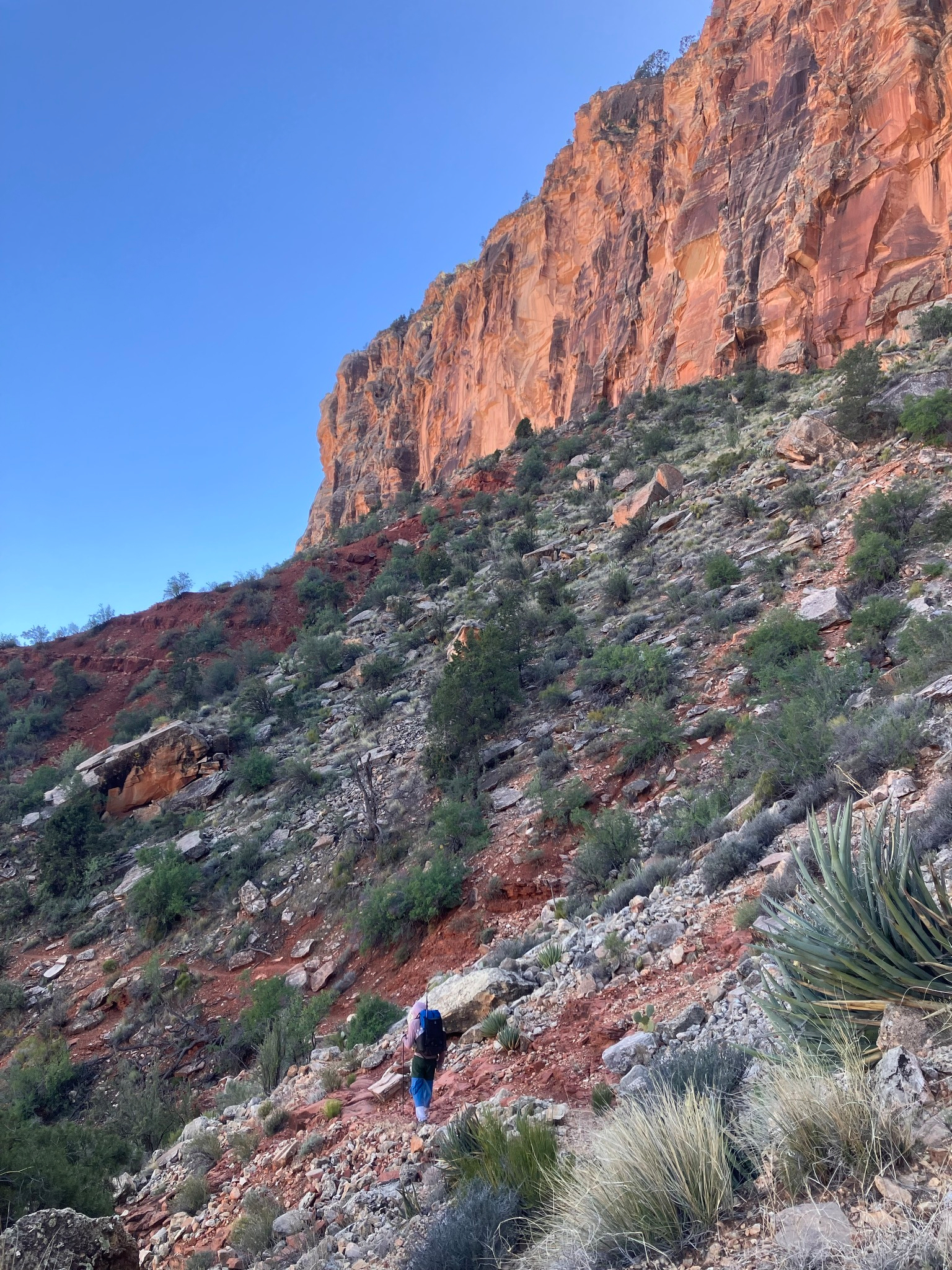
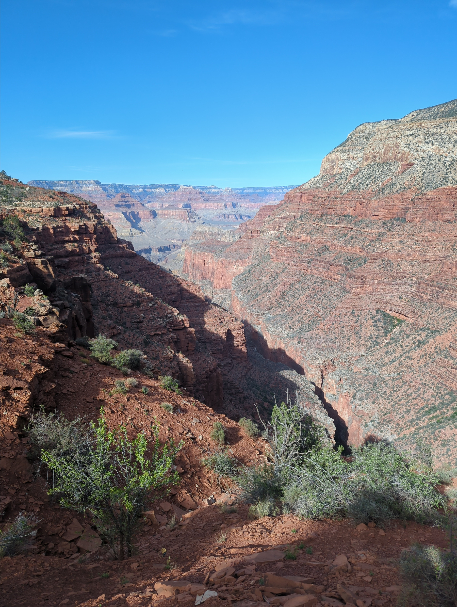
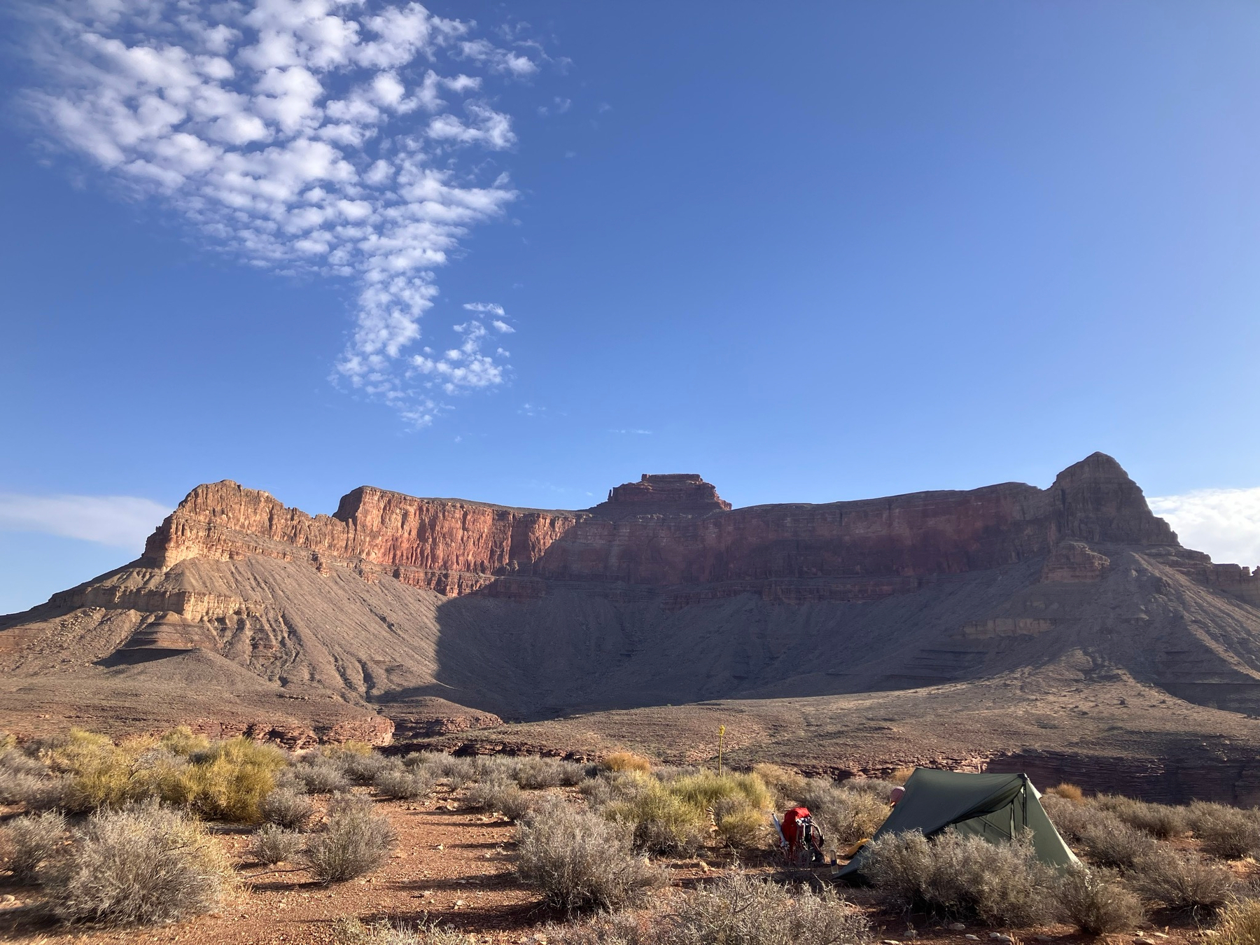
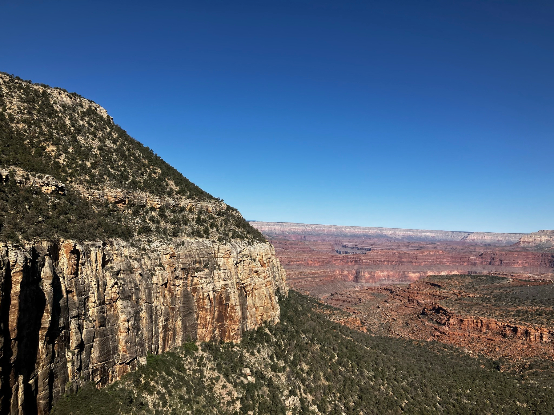
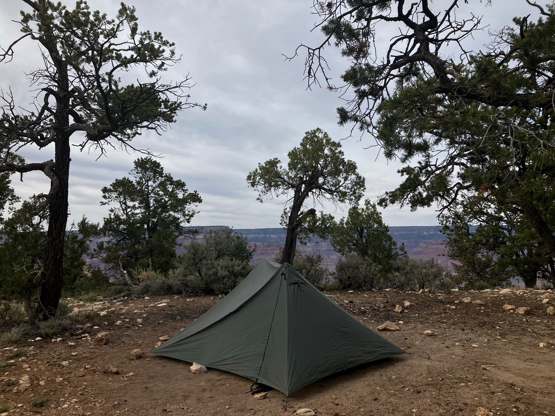
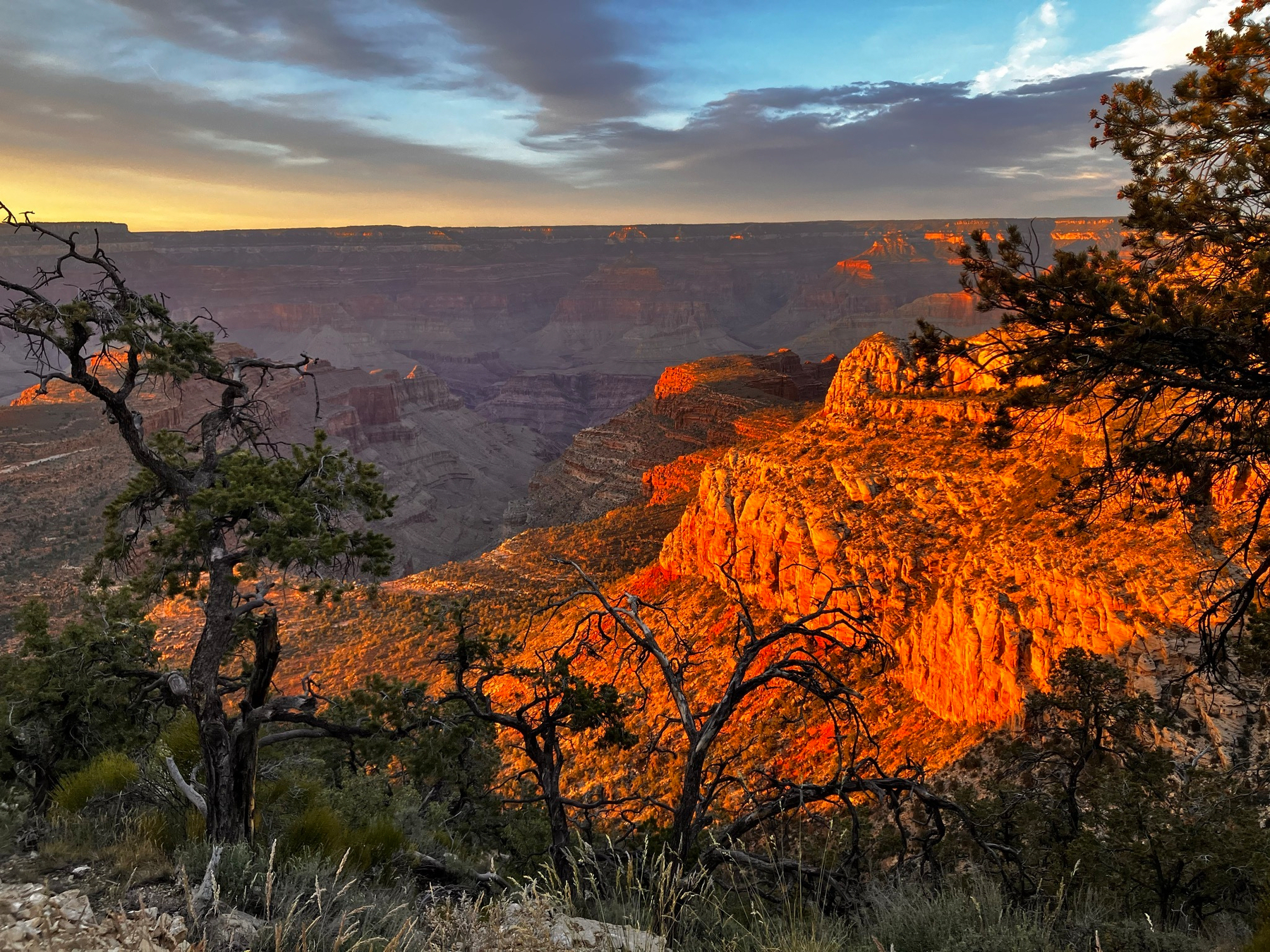
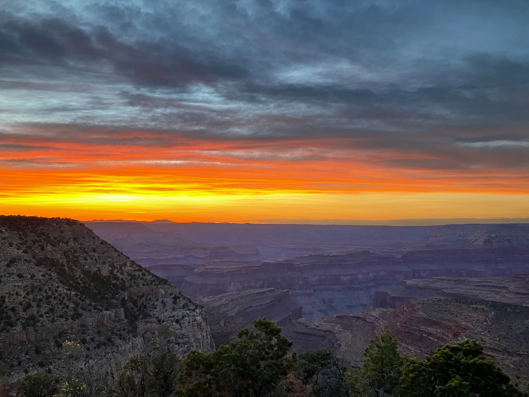
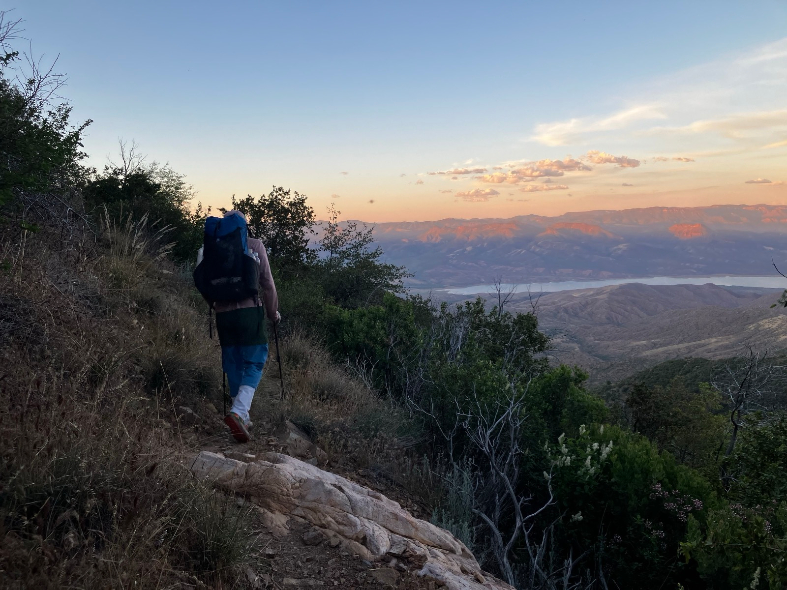
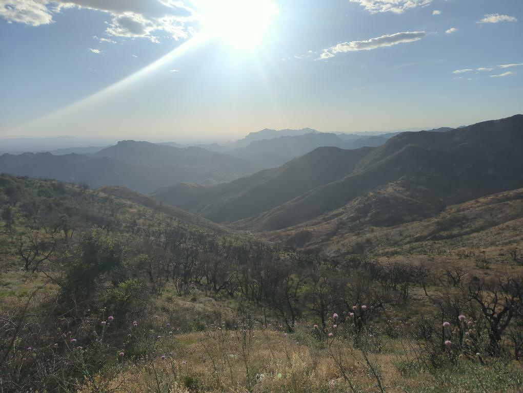
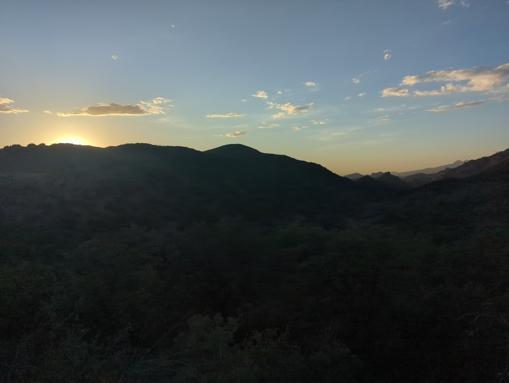
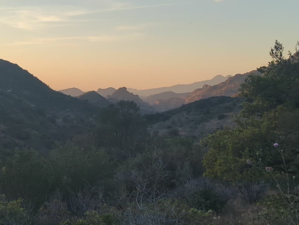
This morning we got picked up by Krocky, one of the few drivers around the South Rim who offers to take folks to remote trailheads. He was fun to talk to—a guy who used to work in Hollywood before taking up the rural life and building an off-grid house in Tusayan. Now he offers shuttles and tours around the canyon and writes novels and music in his free time. He took us to the village to get our permits before we headed out toward South Bass Trailhead. We said goodbye and started on the walk of the last leg to the trailhead, but got lucky when a couple from Flagstaff was able to pick us up and take us the rest of the way. We got to the rim and set up camp for the night, enjoying the spectacular views of the route we would be descending the next day. The colors and shadows in the canyon at sunset were surreal.
4/15/26
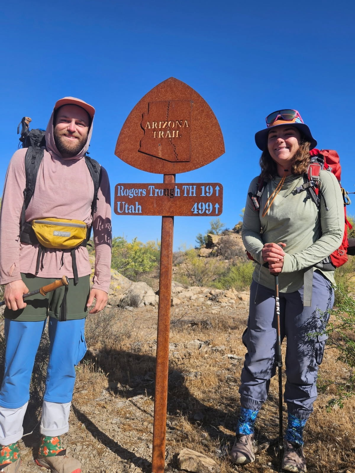
After deliberating for the past couple of days, we decided to go ahead and call it here on the Arizona Trail. We have officially done half of the trail, 400 miles! The mountain ranges and low Sonoran Desert of southern Arizona have been beautiful and a marked change of scenery from the usual places we hike, but we have both been feeling ready to get back to where we really feel at home – in the red sandstone canyons and mesas of the Colorado Plateau in the northern part of the state. Thru-hiking has given us the chance to learn a lot about our backpacking setup (and ourselves!) and gain lots of strength and experience on the trail in a short period of time. At this point though, we are having to hike 15 miles a day on average to get through the rest of the trail on time, and the pace is making it more grueling, exhausting, and rushed than we’d like.
So, we are pivoting up north to the Big Ditch. The normal AZT route through the Grand Canyon is closed until mid-May because of a wildfire last year. Luckily, we scored permits for a week-long trip through the Gems Route, a lesser-visited part of the canyon with lots of scenic side canyons and multiple opportunities to hike down to the Colorado River. We’re excited to get to spend lots of time in the crown jewel of the AZT and Arizona in general, and we timed it so that we can hike fewer miles each day and really savor our time down there. It’s a place we’ve wanted to hike for a long time, and I think it’ll cap off our Arizona adventure perfectly. We made it from Payson to Flagstaff yesterday, and this afternoon we loaded up on groceries and got everything else prepped to head out to the park in the morning.
4/13/26
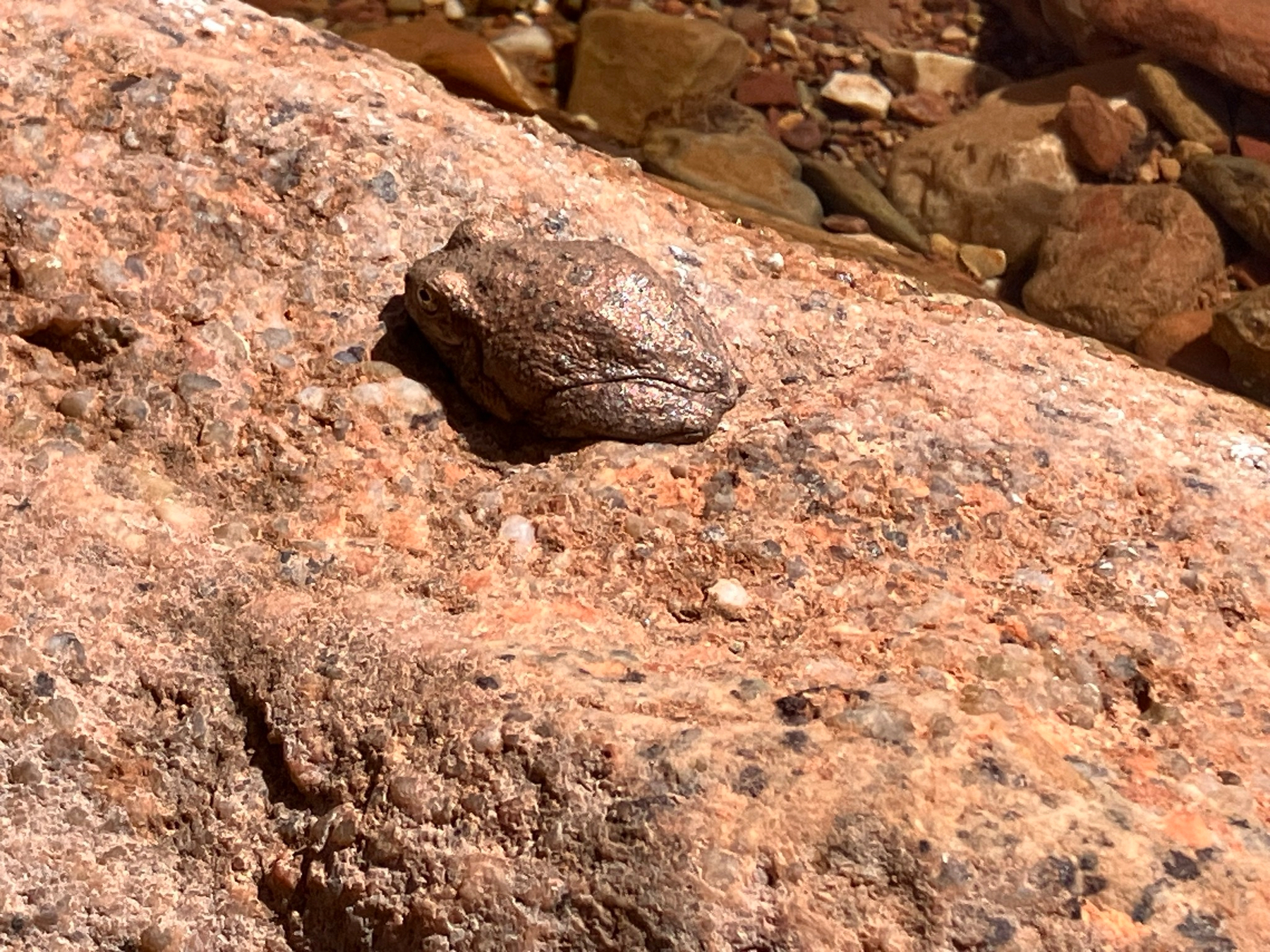
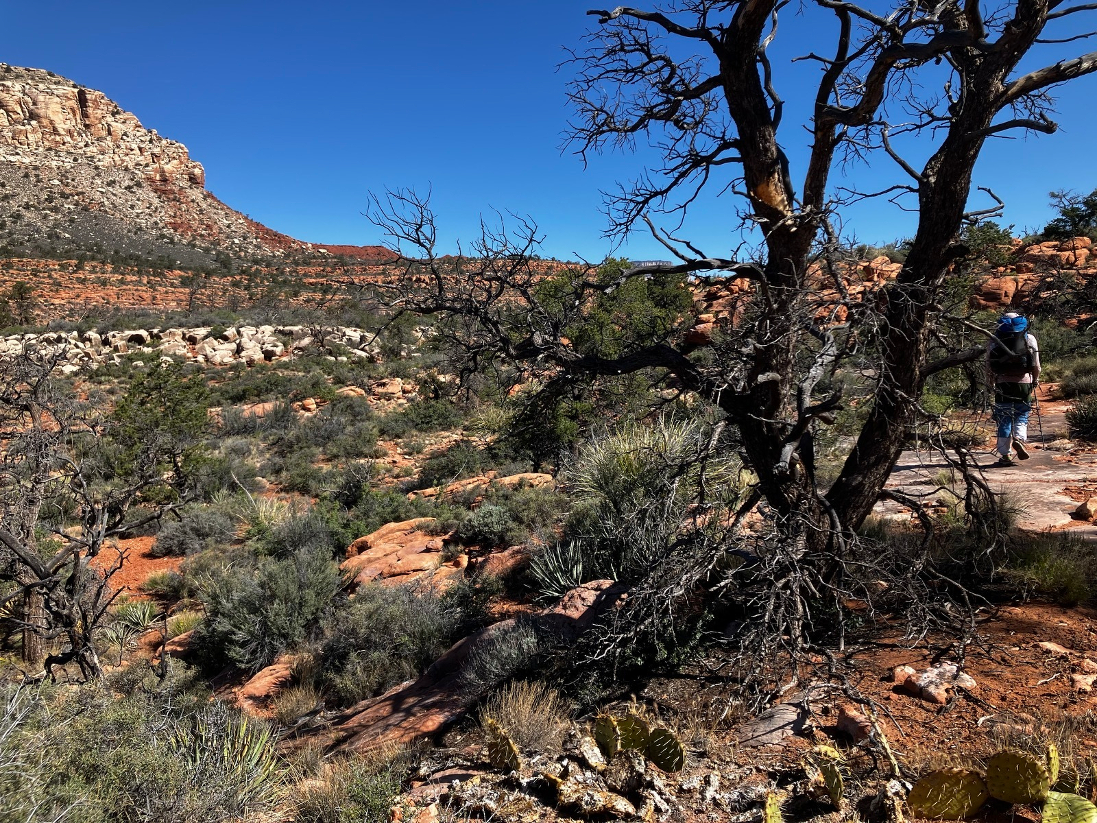
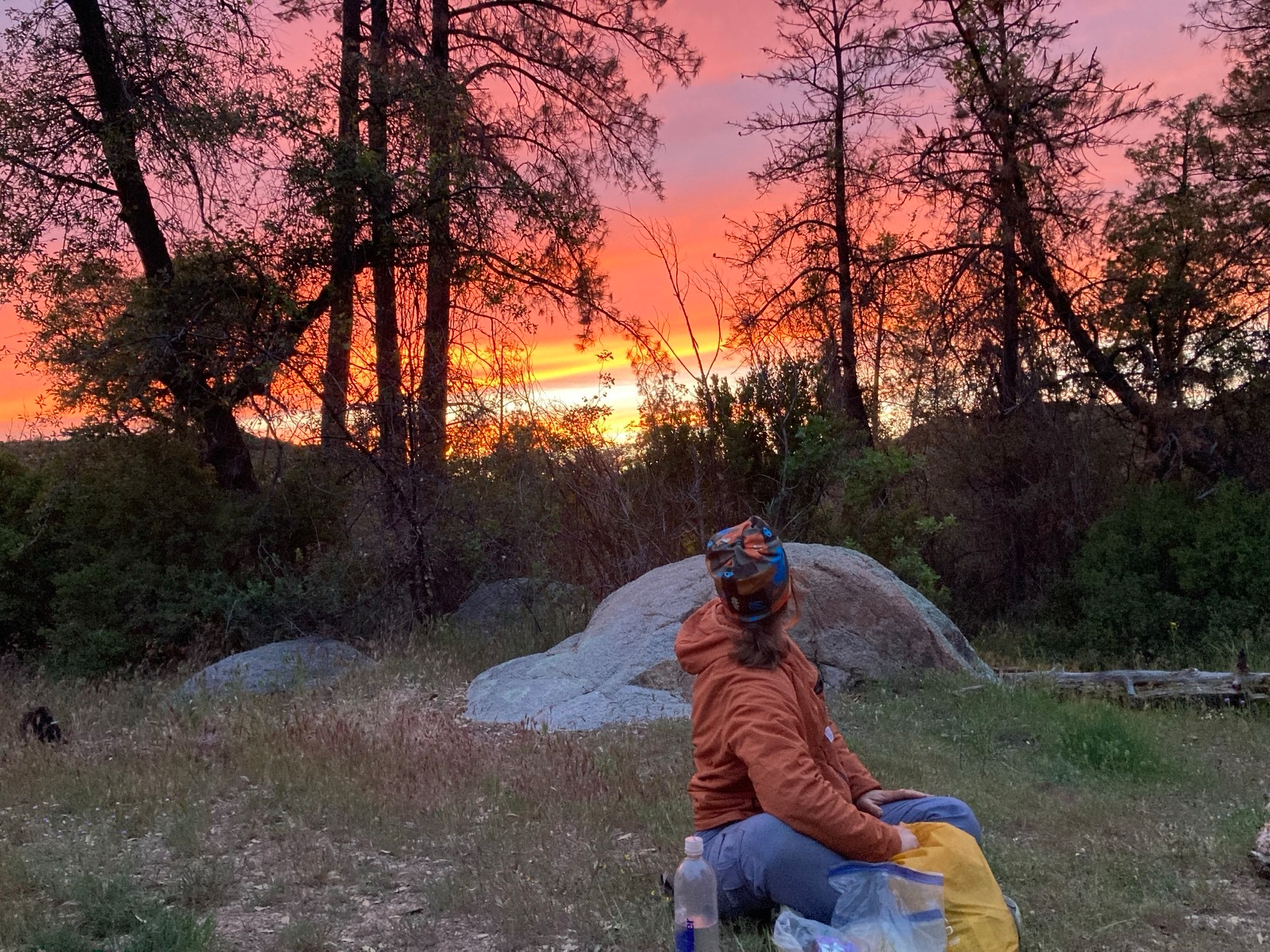
Rose and I mailed ourselves food for this stretch, since the marina at the lake didn’t have a full grocery store. We underestimated the amount we needed, so we decided to go to Payson today after all. The hike was about 10 miles to the highway where our friends had already coordinated a ride with a trail angel. We got to town and crashed in the hotel room. We were still exhausted today, despite the smaller day yesterday. The trail is wearing on us at this point and we talked a lot about calling it, and skipping ahead to the parts we’re really excited for. Going to sleep on it though.
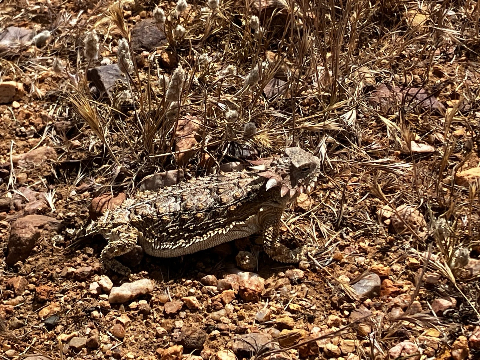
P.S. Try to find the people in that last photo!
4/12/26
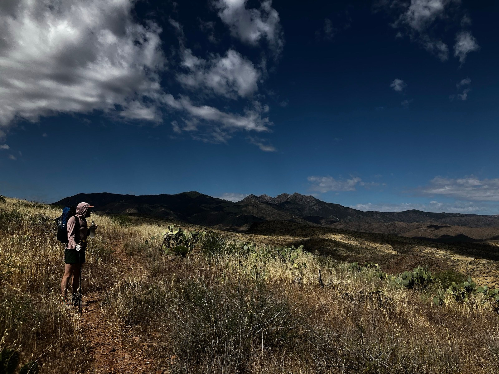
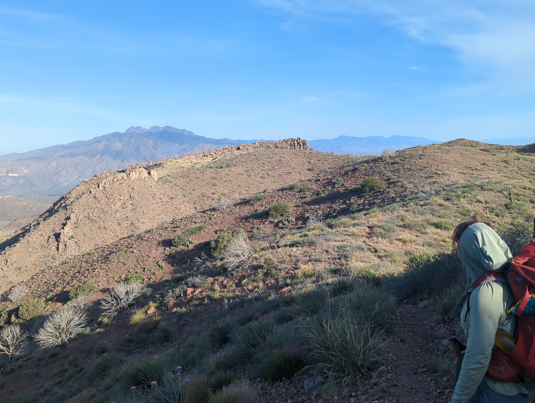
We got up, already sore from yesterday despite our day off in Roosevelt. We decided to do a “smaller” day today at 10 miles, mostly on dirt roads frequented by folks on their four-wheelers and the like, but there were still lots of ups and downs throughout the day to wipe us out. The Four Peaks are one of the prettier mountain ranges we’ve been in so far. Very craggy up high with surprisingly lush foliage in the hills. We found a nice campsite and rested for most of the afternoon, when our two friends from yesterday caught up and we hung out the rest of the evening.
4/11/26
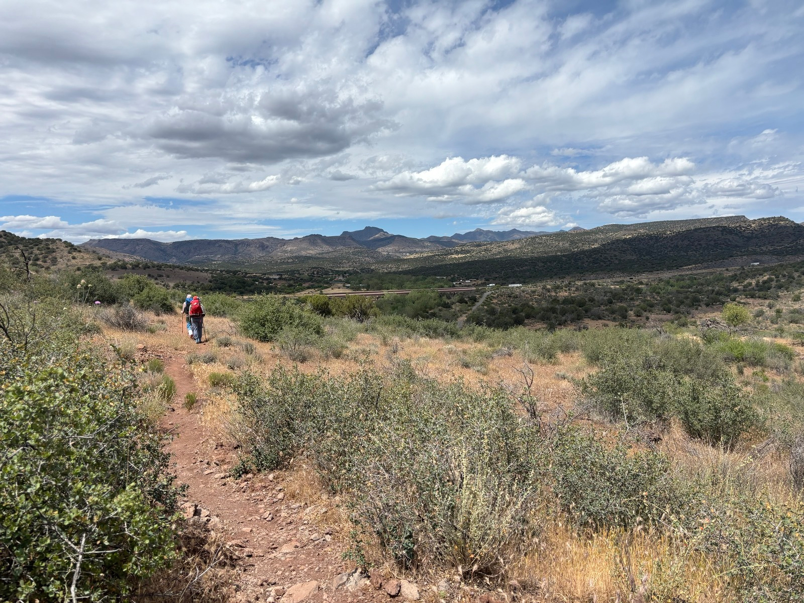
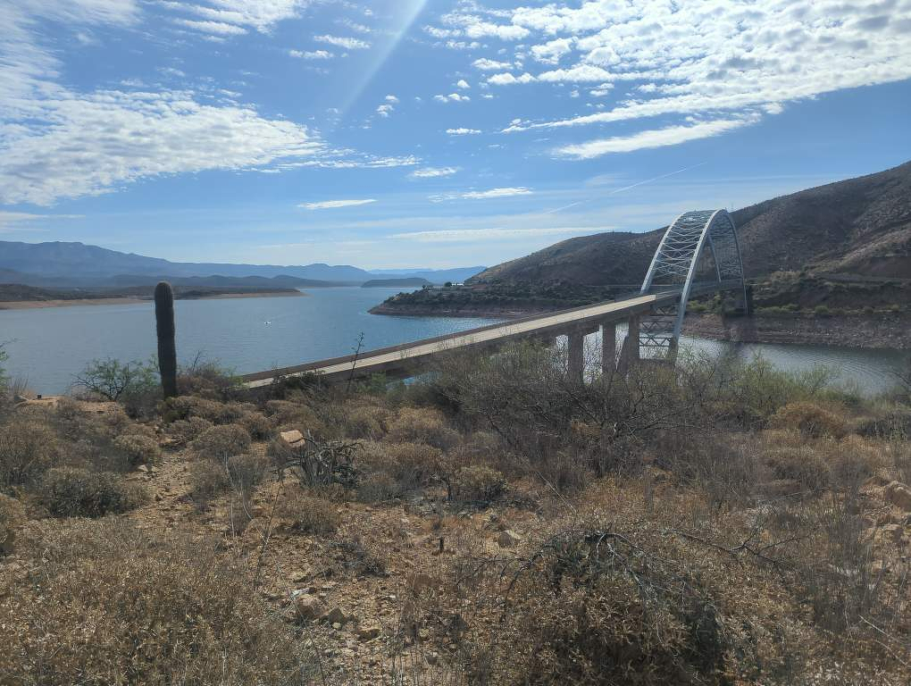
This morning we got a ride back to the marina with a local clockmaker and his family, heading to work for the day in Tonto Basin. We hiked from there along the highway for a bit before starting the big climb into the Four Peaks range. The climb was steep, and the biggest since Mount Lemmon. Partway up we got to a cache where we met another trail angel who was there restocking the water. She even brought cold beer! We also met back up with Little Goat and On The Level, two ladies section-hiking the trail whom we’d met way back before Mica Mountain in Saguaro. We leapfrogged them on the trail for a while after, but Rose and I decided to push to a nice campsite with water at the top of the climb. It ended up being a big day, over 20 miles with 3,600 feet of elevation gain.
4/10/26
Today we took a zero in Roosevelt. We are tired after the climb over the Superstitions, and the next leg is 7 days over two mountain ranges of similar size to get to the town of Pine, so we thought it’d be prudent to rest up. It is nice to watch movies and sit on the couch in the AC all day!
4/9/26
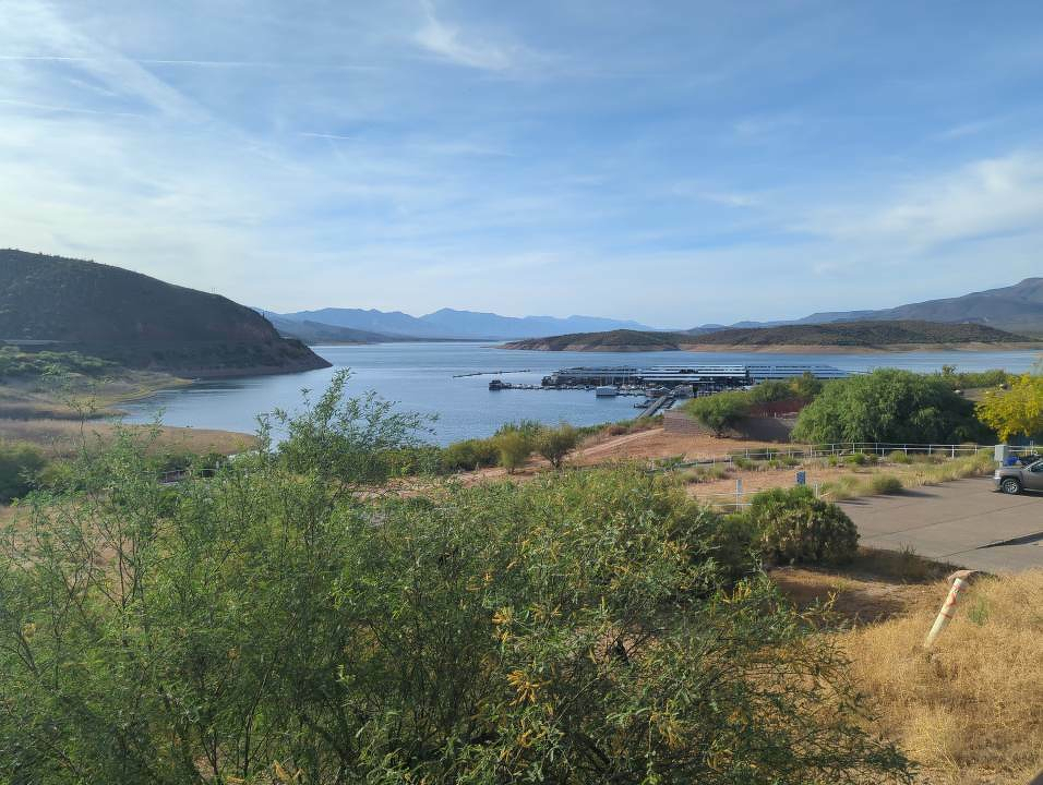
Today was a bit brutal. I woke up with about 50 gnat bites on my legs that I got while we were sitting around getting water at a speing yesterday. Then we descended off the north side of the Superstitions and were expecting a breezy 13 miles. Instead, we were faced with a trail alternating between a rough jeep two-track and a rocky creek bed washed out by recent floods. Going was slow and somewhat treacherous, as we’re finding it is easy to skid out going downhill on this trail. In the late afternoon, grumpy and with low morale, we finally got to the marina at Roosevelt Lake where we decompressed with a few beers and picked up one of the food resupplies we’d mailed ourselves in early March. This area is funny, full of fishing vacationers and bikers. Definitely feels like an Americana time capsule.
4/8/26
We had a pretty good day hiking through the Superstitions today, up and down through saddles and across ridges. We decided to do most of the range today but save the big descent to Roosevelt Lake for tomorrow, and ended up finding a scenic campsite on a ridge after the last climb of the day.
4/7/26
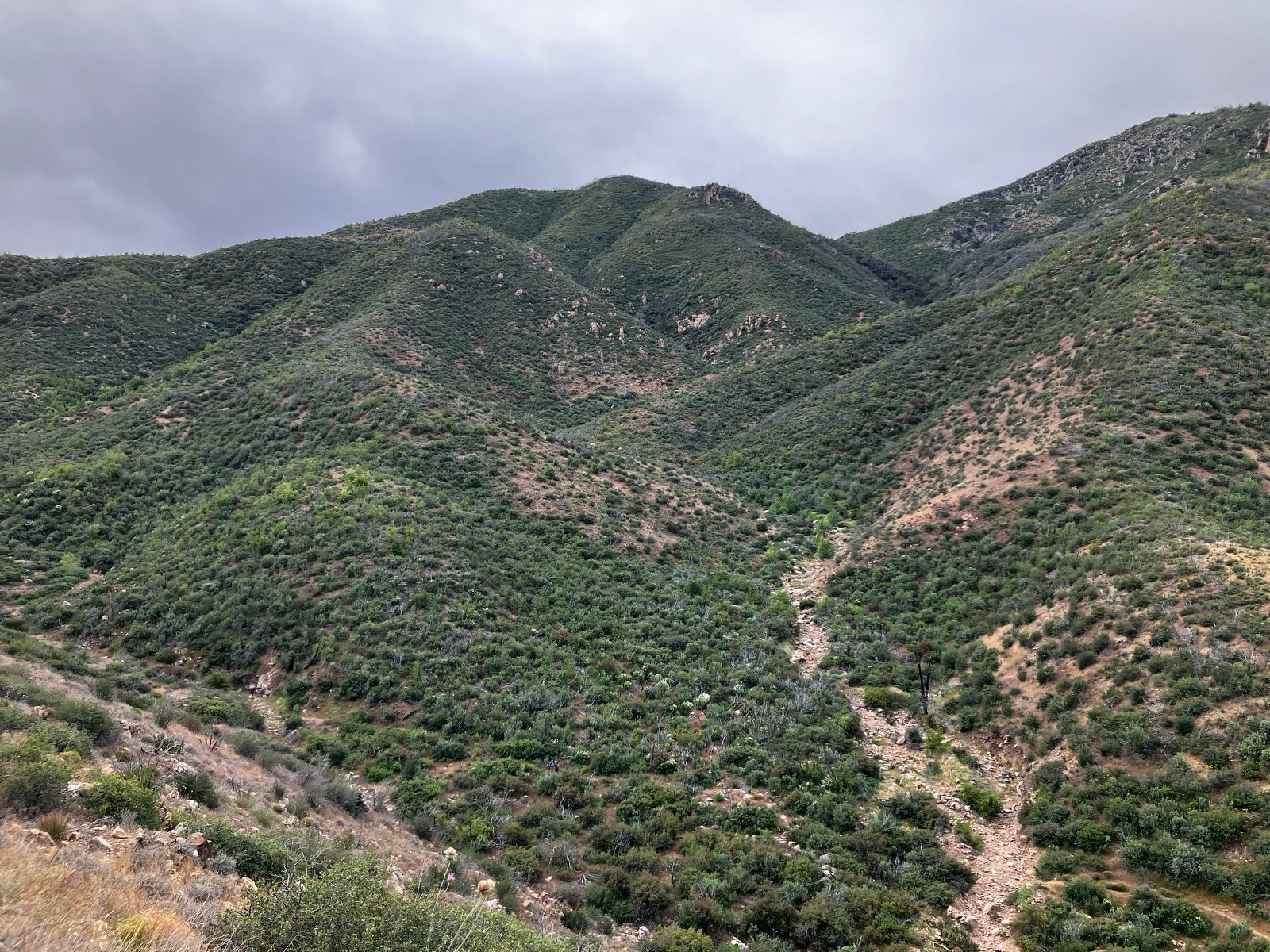
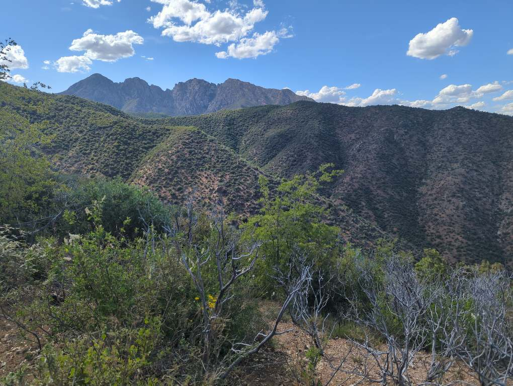
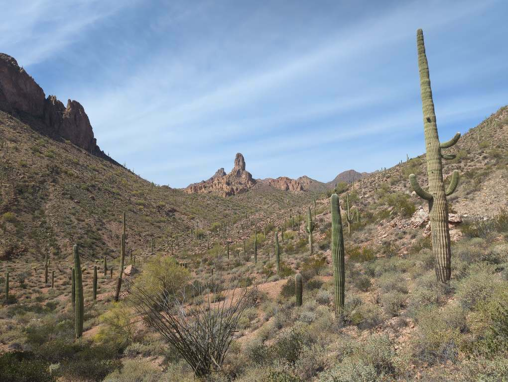
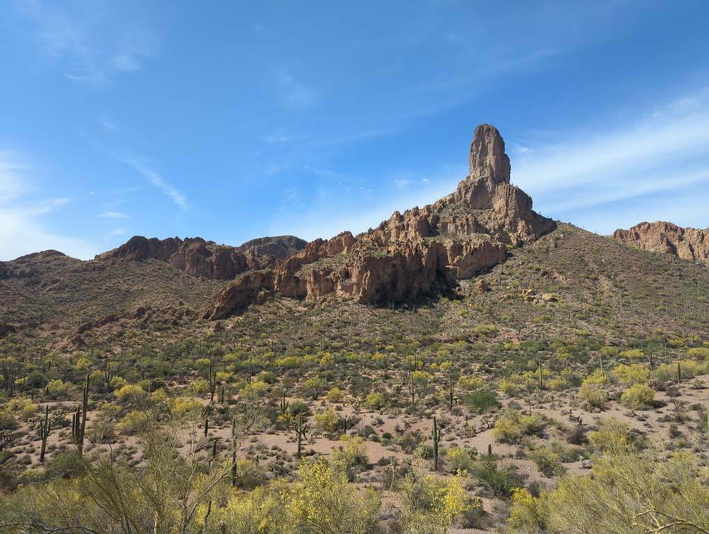
Got on the trail early today thanks to another trail angel offering shuttles to the trailhead. Met a seasoned thru-hiker in the car, Lieutenant Dan, who had some good advice on savoring the small happy moments and taking plenty of short breaks throughout the day. Rose and I got to the trail and started the slow ascent up into the Superstition Mountains, a popular spot for Phoenix hikers and a place full of Native American lore. We were feeling great today, and the climb was no big deal. The last couple of miles were steep, but we made quick work of it and found ourselves up on a ridge with great views back south toward Picketpost Mountain and the town of Superior.
4/6/26
This morning we descended from the mountains to the highway west of the town of Superior. We got a ride into town and grabbed some disappointing Mexican food, then got a disappointing room at a disappointing motel. They can’t all be winners, I guess. We walked into town to get groceries and grab a beer before bed. Decided we wouldn’t take a zero here tomorrow, but at least it is nice to sleep in a bed!
4/5/26
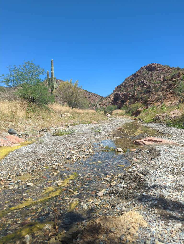
We got a ride from James back to the trail this morning. Rose and I decided to walk on the train tracks for the first stretch to save about 5 miles and lots of PUDs (pointless ups and downs). The walking was easy, but I guess the shade from the tracks in the morning is a favorite of the local snakes because we came upon two rattlers. Yeesh! The trail turned north and we forded the Gila River before taking a break in the shade provided by the riparian zone. The river water was full of silt and hard to filter, but we made it work. Then we came upon a family of trepidatious cows and bulls trying to get a drink too. Finally, we headed out of the river bed and into the low mountain range north of the river. Right away, we realized how hot the climb would be at this time of day, and that we should have been patient and carried more water. We hiked over a saddle to some spectacular canyon views, but still had a few miles to go before the next available water. We finally got there, too thirsty for comfort, and luckily there was a good campsite right by the water so we could rehydrate all night.
4/5/26
We got a ride from James back to the trail this morning. Rose and I decided to walk on the train tracks for the first stretch to save about 5 miles and lots of PUDs (pointless ups and downs). The walking was easy, but I guess the shade from the tracks in the morning is a favorite of the local snakes because we came upon two rattlers. Yeesh! The trail turned north and we forded the Gila River before taking a break in the shade provided by the riparian zone. The river water was full of silt and hard to filter, but we made it work. Then we came upon a family of trepidatious cows and bulls trying to get a drink too. Finally, we headed out of the river bed and into the low mountain range north of the river. Right away, we realized how hot the climb would be at this time of day, and that we should have been patient and carried more water. We hiked over a saddle to some spectacular canyon views, but still had a few miles to go before the next available water. We finally got there, too thirsty for comfort, and luckily there was a good campsite right by the water so we could rehydrate all night.